TODO list #1
Description
Map UX
- legend (bike lane colors)
- configurable colors
- print mode / screenshot / SVG export capability
- more path tooltip/tap tolerance (seems to require canvas render, not SVG)
- more info in tooltips (councillor links, other road info?)
- GitHub link in settings tooltip
URL params
- lat/lon
- zoom
- layers
Layers
- Bike Master Plan
- unprotected bike lanes
- High Injury Network (cf. JC Vision Zero map)
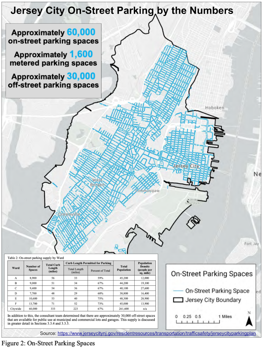
- parking (JC Parking Plan, example)
- NJSP fatal crashes
- Census districts
- car ownership distributions
- parks
- transit
- bus stops/routes
- PATH stations (JC map)
- light rail stations
- Citi Bike docks (JC map, Citi Bike map)
- ferries (stops, routes)
- NJT terminals
- bike parking (JC map)
- schools
- Hoboken data (PBLs, Citi Bike, roads, parking, etc.), other municipalities?
Metadata
Metadata
Assignees
Labels
No labels