See UPDATE.md for instructions on how to update this file.
The list reads config.yml, config_layers.yml and source files from sources/.
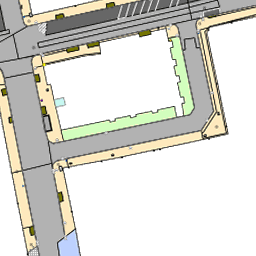
https://mapproxy.codefor.de/tiles/1.0.0/alkis_30/mercator/18/140850/86019.png
-
TMS URL:
https://mapproxy.codefor.de/tiles/1.0.0/alkis_30/mercator/{z}/{x}/{y}.png -
-
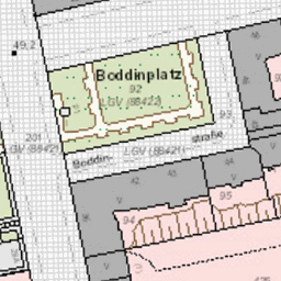
WFSExplorer for https://gdi.berlin.de/services/wms/alkis_bezirke
Show layer config options
[
  {
    "req": {
      "format": "png",
      "layers": "a_alkis_raster",
      "transparent": false,
      "url": "https://gdi.berlin.de/services/wms/alkis"
    },
    "supported_srs": [
      "EPSG:25833"
    ],
    "type": "wms",
    "wms_opts": {
      "version": "1.3.0"
    }
  },
  {
    "req": {
      "format": "png",
      "layers": "bezirksgrenzen",
      "transparent": true,
      "url": "https://gdi.berlin.de/services/wms/alkis_bezirke"
    },
    "supported_srs": [
      "EPSG:25833"
    ],
    "type": "wms",
    "wms_opts": {
      "version": "1.3.0"
    }
  }
]

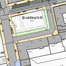
https://mapproxy.codefor.de/tiles/1.0.0/alkis_sw/mercator/18/140850/86019.png
Note
2025-08-02: Added district boundaries (bezirksgrenzen) overlay from gdi.berlin.de/services/wms/alkis_bezirke.
-
TMS URL:
https://mapproxy.codefor.de/tiles/1.0.0/alkis_sw/mercator/{z}/{x}/{y}.png
Show layer config options
[
  {
    "req": {
      "format": "png",
      "layers": "a_alkis_raster_sw",
      "transparent": false,
      "url": "https://gdi.berlin.de/services/wms/alkis"
    },
    "supported_srs": [
      "EPSG:25833"
    ],
    "type": "wms",
    "wms_opts": {
      "version": "1.3.0"
    }
  }
]

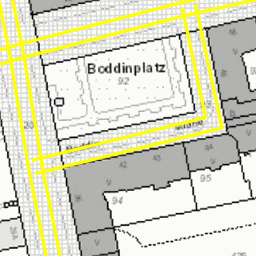
https://mapproxy.codefor.de/tiles/1.0.0/baumbestand_0_1_3_4_merged/mercator/18/140850/86019.png
Note
2025-08-02: Updated to gdi URI and new endpoint and layer setup.
-
TMS URL:
https://mapproxy.codefor.de/tiles/1.0.0/baumbestand_0_1_3_4_merged/mercator/{z}/{x}/{y}.png -
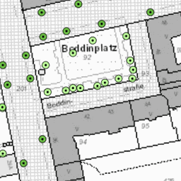
Comprehensive layer with all tree types for mapping.
-
WFSExplorer for https://gdi.berlin.de/services/wms/baumbestand
-
WFSExplorer for https://gdi.berlin.de/services/wms/baumbestand_gruen_berlin
Show layer config options
[
  {
    "req": {
      "format": "png",
      "layers": "anlagenbaeume,strassenbaeume",
      "style": "anlagenbaeume,strassenbaeume",
      "transparent": true,
      "url": "https://gdi.berlin.de/services/wms/baumbestand"
    },
    "supported_srs": [
      "EPSG:25833"
    ],
    "type": "wms",
    "wms_opts": {
      "version": "1.3.0"
    }
  },
  {
    "req": {
      "format": "png",
      "layers": "anlagenbaum_gruenberlin",
      "style": "baum_gruen_berlin",
      "transparent": true,
      "url": "https://gdi.berlin.de/services/wms/baumbestand_gruen_berlin"
    },
    "supported_srs": [
      "EPSG:25833"
    ],
    "type": "wms",
    "wms_opts": {
      "version": "1.3.0"
    }
  }
]
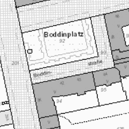
https://mapproxy.codefor.de/tiles/1.0.0/baumbestand_0_1_3_4_alkis/mercator/18/140850/86019.png
Note
2025-08-02: Updated to gdi URI and new endpoint and layer setup.
-
TMS URL:
https://mapproxy.codefor.de/tiles/1.0.0/baumbestand_0_1_3_4_alkis/mercator/{z}/{x}/{y}.png -
Recommended layer for tree mapping with cadastral background. Includes all tree types.
-
WFSExplorer for https://gdi.berlin.de/services/wms/baumbestand
-
WFSExplorer for https://gdi.berlin.de/services/wms/baumbestand_gruen_berlin
Show layer config options
[
  {
    "req": {
      "format": "png",
      "layers": "a_alkis_raster_sw",
      "transparent": false,
      "url": "https://gdi.berlin.de/services/wms/alkis"
    },
    "supported_srs": [
      "EPSG:25833"
    ],
    "type": "wms",
    "wms_opts": {
      "version": "1.3.0"
    }
  },
  {
    "req": {
      "format": "png",
      "layers": "anlagenbaeume,strassenbaeume",
      "style": "anlagenbaeume,strassenbaeume",
      "transparent": true,
      "url": "https://gdi.berlin.de/services/wms/baumbestand"
    },
    "supported_srs": [
      "EPSG:25833"
    ],
    "type": "wms",
    "wms_opts": {
      "version": "1.3.0"
    }
  },
  {
    "req": {
      "format": "png",
      "layers": "anlagenbaum_gruenberlin",
      "style": "baum_gruen_berlin",
      "transparent": true,
      "url": "https://gdi.berlin.de/services/wms/baumbestand_gruen_berlin"
    },
    "supported_srs": [
      "EPSG:25833"
    ],
    "type": "wms",
    "wms_opts": {
      "version": "1.3.0"
    }
  }
]
https://mapproxy.codefor.de/tiles/1.0.0/atkis_dom/mercator/18/140850/86019.png
Note
2024-05-03: Updated to use gdi.berlin.de.
-
TMS URL:
https://mapproxy.codefor.de/tiles/1.0.0/atkis_dom/mercator/{z}/{x}/{y}.png -
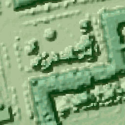
OK for trees and houses, but otherwise pretty pixelated.
Show layer config options
[
  {
    "req": {
      "format": "png",
      "layers": "b_bdom,a_bdom_schummerung",
      "style": "bdom,bdom_schummerung",
      "transparent": true,
      "url": "https://gdi.berlin.de/services/wms/bdom"
    },
    "supported_srs": [
      "EPSG:25833"
    ],
    "type": "wms",
    "wms_opts": {
      "version": "1.3.0"
    }
  }
]
https://mapproxy.codefor.de/tiles/1.0.0/fussgaengernetz_alkis/mercator/18/140850/86019.png
-
TMS URL:
https://mapproxy.codefor.de/tiles/1.0.0/fussgaengernetz_alkis/mercator/{z}/{x}/{y}.png -
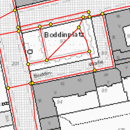
I did not check if the OSM license waiver applies to this dataset as well.
-
WFSExplorer for https://gdi.berlin.de/services/wms/fussgaengernetz
Show layer config options
[
  {
    "req": {
      "format": "png",
      "layers": "a_alkis_raster_sw",
      "transparent": false,
      "url": "https://gdi.berlin.de/services/wms/alkis"
    },
    "supported_srs": [
      "EPSG:25833"
    ],
    "type": "wms",
    "wms_opts": {
      "version": "1.3.0"
    }
  },
  {
    "req": {
      "format": "png",
      "layers": "b_strassenelemente,a_verbindungspunkte",
      "style": "strassenelemente,verbindungspunkte",
      "transparent": true,
      "url": "https://gdi.berlin.de/services/wms/fussgaengernetz"
    },
    "supported_srs": [
      "EPSG:25833"
    ],
    "type": "wms",
    "wms_opts": {
      "version": "1.3.0"
    }
  }
]
https://mapproxy.codefor.de/tiles/1.0.0/strassenbefahrung/mercator/18/140850/86019.png
Note
2024-05-03: Updated to use gdi.berlin.de.
-
TMS URL:
https://mapproxy.codefor.de/tiles/1.0.0/strassenbefahrung/mercator/{z}/{x}/{y}.png -
Remember that this data is from 2014. 2024-05: Used in https://github.com/osmlab/editor-layer-index/blob/gh-pages/sources/europe/de/BerlinStrassenbefahrung.geojson?short_path=10b5602
-
WFSExplorer for https://gdi.berlin.de/services/wms/strassenbefahrung
Show layer config options
[
  {
    "req": {
      "format": "png",
      "layers": "cm_fahrbahn,cl_gehweg,ck_parkflaeche,cj_fussgaengerzone,ci_oeffentlicher_platz,ch_radweg,cg_baustelle,cf_trennstreifen,ce_gruenflaeche,cd_rampe,cc_treppe,cb_haltestellenwartebereich,ca_haltebereich_bus,bz_gleiskoerper_strab,by_gehwegueberfahrt,bx_fahrbahnschwelle,bw_aufmerksamkeitsfeld,bv_springbrunnen_zierbrunnen,bu_recycling_container,bu1_kleinbauten_sondernutzung,bt_kabelschacht,bs_induktionsschleife,br_fahrgastunterstand,bq_fahrradstaender,bp_fahrbahnmarkierung_flaeche,bo_denkmal,bn_baumscheibe,bm_zugangsbauwerk,bl_strassenentwaesserungsrinne,bk_strassenbegrenzung,bj_sitzbank,bi_schranke,bh_mauer,bg_leitplanke,bf_gelaender,be_fahrbahnmarkierunglinie,bd_bordstein,bc_aufmerksamkeitsstreifen,bb_verkehrsschutzgitter,ba_telefonzelle_telefonstele,az_taxirufsaeule,ay_streugutbehaelter,ax_strassensinkkasten,aw_spielgeraet,av_poller,au_parkscheinautomat,at_mast_lsa,as_mast,ar_kanaldeckel,ar1_kabelkasten,aq_hydrant,ap_handsteuergeraet_lsa,ao_gebaeudeeingang,an_fahrbahnmarkierung_piktogramm,am_fahnenmast,al_durchfahrtshoehe,ak_briefkasten,aj_anlegestelle,ai_anforderungstaster_radverkehr,ah_abfallbehaelter_muellbox,ag_werbesaeule,af_wasserpumpen_brunnen,ae_viz_infotafel,ad_uhr,ac_trinkwasserbrunnen_wasserspender,ab_touchpoint,aa_verkehrszeichen",
      "transparent": true,
      "url": "https://gdi.berlin.de/services/wms/strassenbefahrung"
    },
    "supported_srs": [
      "EPSG:25833"
    ],
    "type": "wms",
    "wms_opts": {
      "version": "1.3.0"
    }
  }
]
https://mapproxy.codefor.de/tiles/1.0.0/strassenbefahrung_alkis/mercator/18/140850/86019.png
Note
2024-05-03: Updated to use gdi.berlin.de.
-
TMS URL:
https://mapproxy.codefor.de/tiles/1.0.0/strassenbefahrung_alkis/mercator/{z}/{x}/{y}.png -
Remember that this data is from 2014. 2024-05: Used in https://github.com/osmlab/editor-layer-index/blob/gh-pages/sources/europe/de/BerlinStrassenbefahrungAlkis.geojson?short_path=10b5602
-
WFSExplorer for https://gdi.berlin.de/services/wms/strassenbefahrung
Show layer config options
[
  {
    "req": {
      "format": "png",
      "layers": "a_alkis_raster_sw",
      "transparent": false,
      "url": "https://gdi.berlin.de/services/wms/alkis"
    },
    "supported_srs": [
      "EPSG:25833"
    ],
    "type": "wms",
    "wms_opts": {
      "version": "1.3.0"
    }
  },
  {
    "req": {
      "format": "png",
      "layers": "cm_fahrbahn,cl_gehweg,ck_parkflaeche,cj_fussgaengerzone,ci_oeffentlicher_platz,ch_radweg,cg_baustelle,cf_trennstreifen,ce_gruenflaeche,cd_rampe,cc_treppe,cb_haltestellenwartebereich,ca_haltebereich_bus,bz_gleiskoerper_strab,by_gehwegueberfahrt,bx_fahrbahnschwelle,bw_aufmerksamkeitsfeld,bv_springbrunnen_zierbrunnen,bu_recycling_container,bu1_kleinbauten_sondernutzung,bt_kabelschacht,bs_induktionsschleife,br_fahrgastunterstand,bq_fahrradstaender,bp_fahrbahnmarkierung_flaeche,bo_denkmal,bn_baumscheibe,bm_zugangsbauwerk,bl_strassenentwaesserungsrinne,bk_strassenbegrenzung,bj_sitzbank,bi_schranke,bh_mauer,bg_leitplanke,bf_gelaender,be_fahrbahnmarkierunglinie,bd_bordstein,bc_aufmerksamkeitsstreifen,bb_verkehrsschutzgitter,ba_telefonzelle_telefonstele,az_taxirufsaeule,ay_streugutbehaelter,ax_strassensinkkasten,aw_spielgeraet,av_poller,au_parkscheinautomat,at_mast_lsa,as_mast,ar_kanaldeckel,ar1_kabelkasten,aq_hydrant,ap_handsteuergeraet_lsa,ao_gebaeudeeingang,an_fahrbahnmarkierung_piktogramm,am_fahnenmast,al_durchfahrtshoehe,ak_briefkasten,aj_anlegestelle,ai_anforderungstaster_radverkehr,ah_abfallbehaelter_muellbox,ag_werbesaeule,af_wasserpumpen_brunnen,ae_viz_infotafel,ad_uhr,ac_trinkwasserbrunnen_wasserspender,ab_touchpoint,aa_verkehrszeichen",
      "transparent": true,
      "url": "https://gdi.berlin.de/services/wms/strassenbefahrung"
    },
    "supported_srs": [
      "EPSG:25833"
    ],
    "type": "wms",
    "wms_opts": {
      "version": "1.3.0"
    }
  }
]
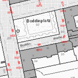
https://mapproxy.codefor.de/tiles/1.0.0/tempolimits_alkis/mercator/18/140850/86019.png
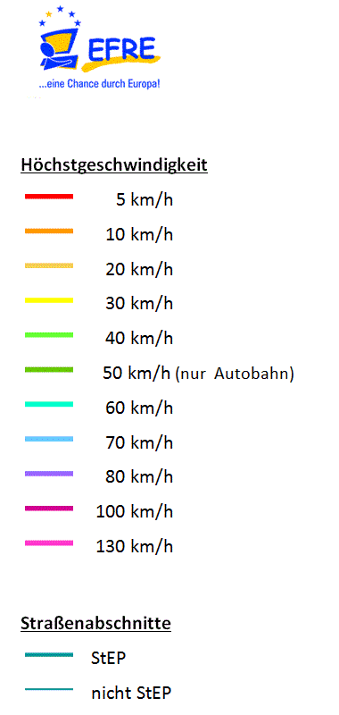
Dokumentation: https://fbinter.stadt-berlin.de/fb_daten/beschreibung/datenformatbeschreibung/Datenformatbeschreibung_Tempolimits.pdf
Legende: https://fbinter.stadt-berlin.de/fb_daten/legenden/leg_tempolimits.png
-
TMS URL:
https://mapproxy.codefor.de/tiles/1.0.0/tempolimits_alkis/mercator/{z}/{x}/{y}.png -
I did not check if the OSM license waiver applies to this dataset as well.
-
WFSExplorer for https://gdi.berlin.de/services/wms/tempolimits
Show layer config options
[
  {
    "req": {
      "format": "png",
      "layers": "a_alkis_raster_sw",
      "transparent": false,
      "url": "https://gdi.berlin.de/services/wms/alkis"
    },
    "supported_srs": [
      "EPSG:25833"
    ],
    "type": "wms",
    "wms_opts": {
      "version": "1.3.0"
    }
  },
  {
    "req": {
      "format": "png",
      "layers": "hoechstgeschwindigkeit",
      "style": "tempolimits_vmax",
      "transparent": true,
      "url": "https://gdi.berlin.de/services/wms/tempolimits"
    },
    "supported_srs": [
      "EPSG:25833"
    ],
    "type": "wms",
    "wms_opts": {
      "version": "1.3.0"
    }
  }
]

https://mapproxy.codefor.de/tiles/1.0.0/postleitzahlen_alkis/mercator/18/140850/86019.png
Note
2025-08-02: Added postal code boundaries from gdi.berlin.de.
-
TMS URL:
https://mapproxy.codefor.de/tiles/1.0.0/postleitzahlen_alkis/mercator/{z}/{x}/{y}.png -
Useful for understanding postal code boundaries when mapping addresses.
-
WFSExplorer for https://gdi.berlin.de/services/wms/postleitzahlen
Show layer config options
[
  {
    "req": {
      "format": "png",
      "layers": "a_alkis_raster_sw",
      "transparent": false,
      "url": "https://gdi.berlin.de/services/wms/alkis"
    },
    "supported_srs": [
      "EPSG:25833"
    ],
    "type": "wms",
    "wms_opts": {
      "version": "1.3.0"
    }
  },
  {
    "req": {
      "format": "png",
      "layers": "postleitzahlen",
      "style": "postleitzahlen",
      "transparent": true,
      "url": "https://gdi.berlin.de/services/wms/postleitzahlen"
    },
    "supported_srs": [
      "EPSG:25833"
    ],
    "type": "wms",
    "wms_opts": {
      "version": "1.3.0"
    }
  }
]
https://mapproxy.codefor.de/tiles/1.0.0/abstell_mikromob_alkis/mercator/18/140850/86019.png
Note
2025-08-02: Added micromobility parking areas from gdi.berlin.de. Shows designated parking areas for rental bikes, e-scooters and other micromobility vehicles.
-
TMS URL:
https://mapproxy.codefor.de/tiles/1.0.0/abstell_mikromob_alkis/mercator/{z}/{x}/{y}.png -
Useful for mapping designated parking areas for shared mobility services. Consider adding amenity=bicycle_parking with appropriate tags.
-
WFSExplorer for https://gdi.berlin.de/services/wms/abstell_mikromob
Show layer config options
[
  {
    "req": {
      "format": "png",
      "layers": "a_alkis_raster_sw",
      "transparent": false,
      "url": "https://gdi.berlin.de/services/wms/alkis"
    },
    "supported_srs": [
      "EPSG:25833"
    ],
    "type": "wms",
    "wms_opts": {
      "version": "1.3.0"
    }
  },
  {
    "req": {
      "format": "png",
      "layers": "abstell_mikromob",
      "style": "abstell_mikromob",
      "transparent": true,
      "url": "https://gdi.berlin.de/services/wms/abstell_mikromob"
    },
    "supported_srs": [
      "EPSG:25833"
    ],
    "type": "wms",
    "wms_opts": {
      "version": "1.3.0"
    }
  }
]

https://mapproxy.codefor.de/tiles/1.0.0/fahrradreparatur_alkis/mercator/18/140850/86019.png
Note
2025-08-02: Added bicycle repair stations from gdi.berlin.de. Part of the extended environmental traffic management system (eUVM) research project. Stations are placed at locations with high bicycle traffic or where cycling should be promoted. Includes both official "Fahrrad Berlin Design" stations and other known repair stations.
-
TMS URL:
https://mapproxy.codefor.de/tiles/1.0.0/fahrradreparatur_alkis/mercator/{z}/{x}/{y}.png -
Useful for mapping bicycle repair stations. Consider adding amenity=bicycle_repair_station with appropriate tags.
-
WFSExplorer for https://gdi.berlin.de/services/wms/fahrradreparatur
Show layer config options
[
  {
    "req": {
      "format": "png",
      "layers": "a_alkis_raster_sw",
      "transparent": false,
      "url": "https://gdi.berlin.de/services/wms/alkis"
    },
    "supported_srs": [
      "EPSG:25833"
    ],
    "type": "wms",
    "wms_opts": {
      "version": "1.3.0"
    }
  },
  {
    "req": {
      "format": "png",
      "layers": "fahrradreparatur",
      "style": "fahrradreparatur",
      "transparent": true,
      "url": "https://gdi.berlin.de/services/wms/fahrradreparatur"
    },
    "supported_srs": [
      "EPSG:25833"
    ],
    "type": "wms",
    "wms_opts": {
      "version": "1.3.0"
    }
  }
]
https://mapproxy.codefor.de/tiles/1.0.0/k_oeffbeleucht_alkis/mercator/18/140850/86019.png
Note
2025-08-02: Updated to use gdi.berlin.de/services/wms/beleuchtung. 2024-05-03: Added from https://daten.berlin.de/datensaetze/%C3%B6ffentliche-beleuchtung-wms
-
TMS URL:
https://mapproxy.codefor.de/tiles/1.0.0/k_oeffbeleucht_alkis/mercator/{z}/{x}/{y}.png -
I did not check if the OSM license waiver applies to this dataset as well.
-
WFSExplorer for https://gdi.berlin.de/services/wms/beleuchtung
Show layer config options
[
  {
    "req": {
      "format": "png",
      "layers": "a_alkis_raster_sw",
      "transparent": false,
      "url": "https://gdi.berlin.de/services/wms/alkis"
    },
    "supported_srs": [
      "EPSG:25833"
    ],
    "type": "wms",
    "wms_opts": {
      "version": "1.3.0"
    }
  },
  {
    "req": {
      "format": "png",
      "layers": "beleuchtung",
      "style": "beleuchtung",
      "transparent": true,
      "url": "https://gdi.berlin.de/services/wms/beleuchtung"
    },
    "supported_srs": [
      "EPSG:25833"
    ],
    "type": "wms",
    "wms_opts": {
      "version": "1.3.0"
    }
  }
]
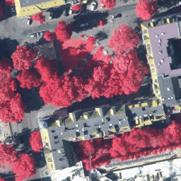
https://mapproxy.codefor.de/tiles/1.0.0/2015_cir/mercator/18/140850/86019.png
-
TMS URL:
https://mapproxy.codefor.de/tiles/1.0.0/2015_cir/mercator/{z}/{x}/{y}.png
Show layer config options
[
  {
    "req": {
      "format": "png",
      "layers": "dop_2015_cir",
      "style": "dop_cir",
      "transparent": false,
      "url": "https://gdi.berlin.de/services/wms/dop_2015"
    },
    "supported_srs": [
      "EPSG:25833"
    ],
    "type": "wms",
    "wms_opts": {
      "version": "1.3.0"
    }
  }
]
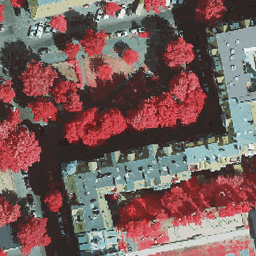
https://mapproxy.codefor.de/tiles/1.0.0/2020_cir/mercator/18/140850/86019.png
-
TMS URL:
https://mapproxy.codefor.de/tiles/1.0.0/2020_cir/mercator/{z}/{x}/{y}.png -
WFSExplorer for https://gdi.berlin.de/services/wms/truedop_2020_sommer
Show layer config options
[
  {
    "req": {
      "format": "png",
      "layers": "truedop_2020_sommer_cir",
      "style": "dop_cir",
      "transparent": false,
      "url": "https://gdi.berlin.de/services/wms/truedop_2020_sommer"
    },
    "supported_srs": [
      "EPSG:25833"
    ],
    "type": "wms",
    "wms_opts": {
      "version": "1.3.0"
    }
  }
]