Don't show maritime boundary labels #17
Description
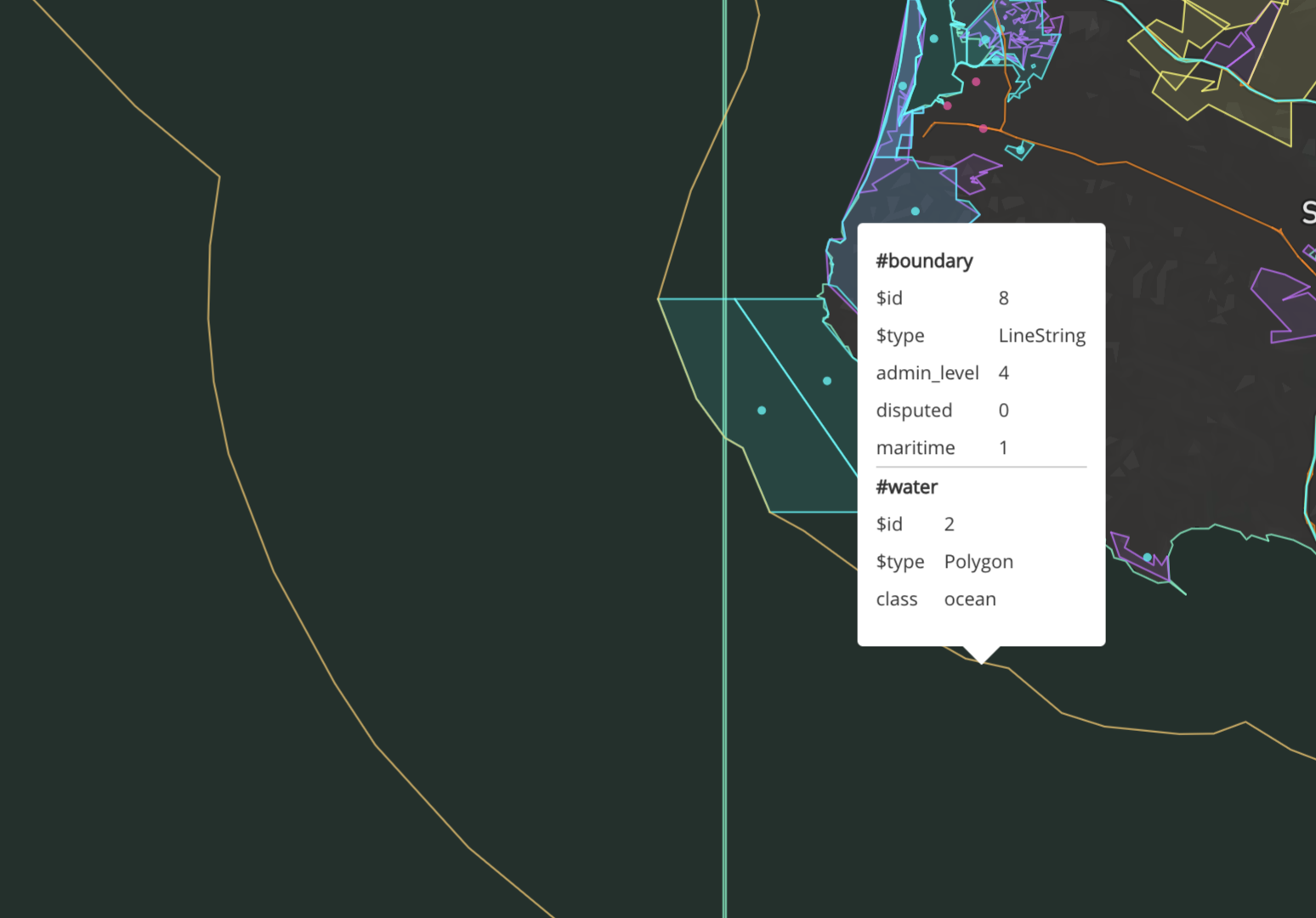
I think the maritime boundary lines are confusing, because most people don't think of/care about where international waters start.
The boundary layer has a maritime key, that's 1 if true.
I think the maritime boundary lines are confusing, because most people don't think of/care about where international waters start.
The boundary layer has a maritime key, that's 1 if true.