![]()
A schema-based, Marshmallow library for validating and working with GeoJSON data according to RFC 7946 specification.
| GeoJSON Objects | Status | Description |
|---|---|---|
| Point | ✅ | A single geographic coordinate |
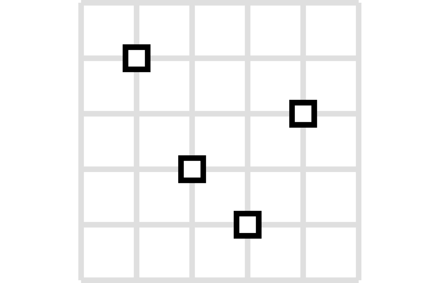
| MultiPoint | ✅ | Multiple points |
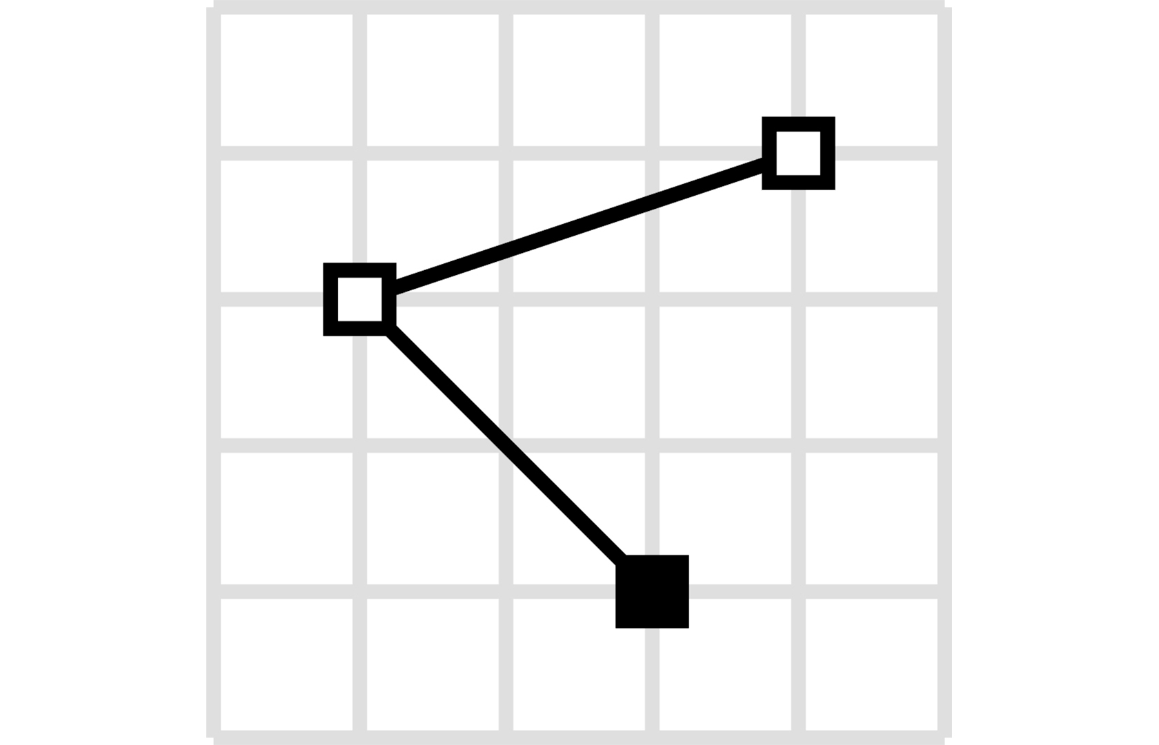
| LineString | ✅ | A sequence of connected points forming a line |
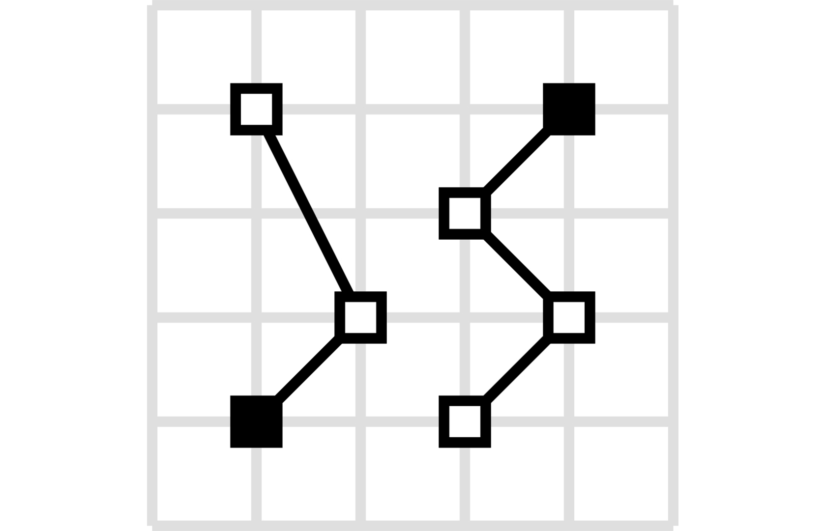
| MultiLineString | ✅ | Multiple line strings |
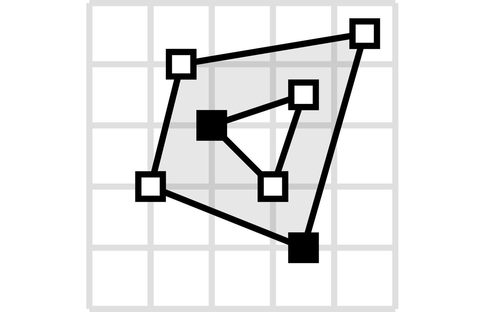
| Polygon | ✅ | A closed area, optionally with holes |
| MultiPolygon | ✅ | Multiple polygons |
| GeometryCollection | ✅ | Collection of different geometry types |
| Feature | ✅ | Geometry with properties |
| FeatureCollection | ✅ | Collection of features |
| Bbox | ✅ | Bounding box validation |
marshmallow-geojson is compatible with Python 3.10 and up.
The recommended way to install is via poetry:
poetry add marshmallow_geojsonUsing pip to install is also possible:
pip install marshmallow-geojsonfrom marshmallow_geojson import GeoJSONSchema
# Create a schema instance
schema = GeoJSONSchema()
# Load GeoJSON from JSON string
geojson_text = '{"type": "Point", "coordinates": [-105.01621, 39.57422]}'
data = schema.loads(geojson_text)
print(data)
# {'type': 'Point', 'coordinates': [-105.01621, 39.57422]}
# Load GeoJSON from dictionary
geojson_dict = {"type": "Point", "coordinates": [-105.01621, 39.57422]}
data = schema.load(geojson_dict)
print(data)
# {'type': 'Point', 'coordinates': [-105.01621, 39.57422]}
# Dump GeoJSON to JSON string
json_str = schema.dumps(geojson_dict)
print(json_str)
# '{"type": "Point", "coordinates": [-105.01621, 39.57422]}'| Type | Visualization | Usage |
|---|---|---|
| Point A single geographic coordinate |
 |
from marshmallow_geojson import GeoJSONSchema

data = {
    "type": "Point",
    "coordinates": [-105.01621, 39.57422]
}
schema = GeoJSONSchema()
point = schema.load(data)

# Or with altitude
data_3d = {
    "type": "Point",
    "coordinates": [-105.01621, 39.57422, 100.5]
}
point_3d = schema.load(data_3d)

# From JSON string
json_str = '{"type": "Point", "coordinates": [-105.01621, 39.57422]}'
point = schema.loads(json_str) |
| MultiPoint Multiple points |
 |
from marshmallow_geojson import GeoJSONSchema

data = {
    "type": "MultiPoint",
    "coordinates": [
        [-105.01621, 39.57422],
        [-80.666513, 35.053994]
    ]
}
schema = GeoJSONSchema()
multi_point = schema.load(data)

# Dump to JSON
json_output = schema.dumps(multi_point) |
| LineString A sequence of connected points forming a line |
 |
from marshmallow_geojson import GeoJSONSchema

data = {
    "type": "LineString",
    "coordinates": [
        [-99.113159, 38.869651],
        [-99.0802, 38.85682],
        [-98.822021, 38.85682],
        [-98.448486, 38.848264]
    ]
}
schema = GeoJSONSchema()
line_string = schema.load(data)

# Minimal LineString (2 points)
minimal = {
    "type": "LineString",
    "coordinates": [[-99.113159, 38.869651], [-99.0802, 38.85682]]
}
line = schema.load(minimal) |
| MultiLineString Multiple line strings |
 |
from marshmallow_geojson import GeoJSONSchema

data = {
    "type": "MultiLineString",
    "coordinates": [
        [[-105.019898, 39.574997],
         [-105.019598, 39.574898],
         [-105.019061, 39.574782]],
        [[-105.017173, 39.574402],
         [-105.01698, 39.574385],
         [-105.016636, 39.574385]]
    ]
}
schema = GeoJSONSchema()
multi_line_string = schema.load(data)

# With bbox
data_with_bbox = {
    "type": "MultiLineString",
    "bbox": [-180.0, -90.0, 180.0, 90.0],
    "coordinates": [[[-105.019898, 39.574997], [-105.019598, 39.574898]]]
}
result = schema.load(data_with_bbox) |
| Polygon A closed area, optionally with holes |
 |
from marshmallow_geojson import GeoJSONSchema

# Simple polygon
data = {
    "type": "Polygon",
    "coordinates": [
        [[100, 0],
         [101, 0],
         [101, 1],
         [100, 1],
         [100, 0]]
    ]
}
schema = GeoJSONSchema()
polygon = schema.load(data)

# Polygon with holes (interior rings)
data_with_holes = {
    "type": "Polygon",
    "coordinates": [
        [[100, 0], [101, 0], [101, 1], [100, 1], [100, 0]],  # Exterior
        [[100.2, 0.2], [100.8, 0.2], [100.8, 0.8], [100.2, 0.8], [100.2, 0.2]]  # Hole
    ]
}
polygon_with_holes = schema.load(data_with_holes) |
| MultiPolygon Multiple polygons |
 |
from marshmallow_geojson import GeoJSONSchema

data = {
    "type": "MultiPolygon",
    "coordinates": [
        [[[107, 7], [108, 7],
          [108, 8], [107, 8],
          [107, 7]]],
        [[[100, 0], [101, 0],
          [101, 1], [100, 1],
          [100, 0]]]
    ]
}
schema = GeoJSONSchema()
multi_polygon = schema.load(data)

# Serialize back to dict
serialized = schema.dump(multi_polygon) |
| GeometryCollection Collection of different geometry types |
 |
from marshmallow_geojson import GeoJSONSchema

data = {
    "type": "GeometryCollection",
    "geometries": [
        {
            "type": "Point",
            "coordinates": [-80.660805, 35.049392]
        },
        {
            "type": "Polygon",
            "coordinates": [[[-80.664582, 35.044965],
                             [-80.663874, 35.04428],
                             [-80.662586, 35.04558],
                             [-80.663444, 35.046036],
                             [-80.664582, 35.044965]]]
        },
        {
            "type": "LineString",
            "coordinates": [[-80.662372, 35.059509],
                            [-80.662693, 35.059263],
                            [-80.662844, 35.05893]]
        }
    ]
}
schema = GeoJSONSchema()
geometry_collection = schema.load(data)

# Empty GeometryCollection
empty = {
    "type": "GeometryCollection",
    "geometries": []
}
empty_collection = schema.load(empty) |
A geometry with properties.
from marshmallow_geojson import GeoJSONSchema

# Basic Feature
data = {
    "type": "Feature",
    "properties": {
        "name": "Dinagat Islands",
        "population": 10000
    },
    "geometry": {
        "type": "Polygon",
        "coordinates": [
            [
                [-80.724878, 35.265454],
                [-80.722646, 35.260338],
                [-80.720329, 35.260618],
                [-80.71681, 35.255361],
                [-80.704793, 35.268397],
                [-80.724878, 35.265454]
            ]
        ]
    }
}
schema = GeoJSONSchema()
feature = schema.load(data)

# Feature with Point geometry
point_feature = {
    "type": "Feature",
    "geometry": {
        "type": "Point",
        "coordinates": [-74.006, 40.7128]
    },
    "properties": {
        "name": "New York",
        "population": 8336817
    }
}
feature = schema.load(point_feature)

# Feature with null geometry (unlocated feature)
null_geometry_feature = {
    "type": "Feature",
    "geometry": None,
    "properties": {
        "name": "Unknown Location"
    }
}
feature = schema.load(null_geometry_feature)

# Feature with ID
feature_with_id = {
    "type": "Feature",
    "id": "feature-123",
    "geometry": {
        "type": "Point",
        "coordinates": [-105.01621, 39.57422]
    },
    "properties": {
        "name": "Test Feature"
    }
}
feature = schema.load(feature_with_id)

# Feature with bbox
feature_with_bbox = {
    "type": "Feature",
    "bbox": [-180.0, -90.0, 180.0, 90.0],
    "geometry": {
        "type": "Point",
        "coordinates": [-105.01621, 39.57422]
    },
    "properties": {}
}
feature = schema.load(feature_with_bbox)A collection of features.
from marshmallow_geojson import GeoJSONSchema

# Basic FeatureCollection
data = {
    "type": "FeatureCollection",
    "features": [
        {
            "type": "Feature",
            "geometry": {
                "type": "Point",
                "coordinates": [-80.870885, 35.215151]
            },
            "properties": {
                "name": "Location 1"
            }
        },
        {
            "type": "Feature",
            "geometry": {
                "type": "Polygon",
                "coordinates": [
                    [
                        [-80.724878, 35.265454],
                        [-80.722646, 35.260338],
                        [-80.720329, 35.260618],
                        [-80.704793, 35.268397],
                        [-80.724878, 35.265454]
                    ]
                ]
            },
            "properties": {
                "name": "Location 2"
            }
        }
    ]
}
schema = GeoJSONSchema()
feature_collection = schema.load(data)

# Empty FeatureCollection
empty_fc = {
    "type": "FeatureCollection",
    "features": []
}
empty_collection = schema.load(empty_fc)

# FeatureCollection with mixed geometry types
mixed_fc = {
    "type": "FeatureCollection",
    "features": [
        {
            "type": "Feature",
            "geometry": {"type": "Point", "coordinates": [-105.01621, 39.57422]},
            "properties": {"type": "point"}
        },
        {
            "type": "Feature",
            "geometry": {
                "type": "LineString",
                "coordinates": [[-99.113159, 38.869651], [-99.0802, 38.85682]]
            },
            "properties": {"type": "line"}
        },
        {
            "type": "Feature",
            "geometry": {
                "type": "Polygon",
                "coordinates": [[[100, 0], [101, 0], [101, 1], [100, 1], [100, 0]]]
            },
            "properties": {"type": "polygon"}
        }
    ]
}
mixed_collection = schema.load(mixed_fc)

# FeatureCollection with bbox
fc_with_bbox = {
    "type": "FeatureCollection",
    "bbox": [-180.0, -90.0, 180.0, 90.0],
    "features": [
        {
            "type": "Feature",
            "geometry": {"type": "Point", "coordinates": [-105.01621, 39.57422]},
            "properties": {}
        }
    ]
}
collection = schema.load(fc_with_bbox)

# Serialize FeatureCollection to JSON
json_output = schema.dumps(feature_collection)marshmallow-geojson provides a universal GeoJSONSchema that automatically handles all GeoJSON object types. This is a unique feature not available in other GeoJSON libraries.
from marshmallow_geojson import GeoJSONSchema

schema = GeoJSONSchema()

# Automatically handles Point
point_data = {"type": "Point", "coordinates": [-105.01621, 39.57422]}
point = schema.load(point_data)

# Automatically handles Feature
feature_data = {
    "type": "Feature",
    "geometry": {"type": "Point", "coordinates": [-105.01621, 39.57422]},
    "properties": {"name": "Test"}
}
feature = schema.load(feature_data)

# Automatically handles FeatureCollection
fc_data = {
    "type": "FeatureCollection",
    "features": [feature_data]
}
feature_collection = schema.load(fc_data)

# Works with mixed types in many=True mode
schema_many = GeoJSONSchema(many=True)
mixed_data = [point_data, feature_data, fc_data]
results = schema_many.load(mixed_data)

# Load from JSON string - automatically detects type
json_point = '{"type": "Point", "coordinates": [-105.01621, 39.57422]}'
point = schema.loads(json_point)

json_feature = '{"type": "Feature", "geometry": {"type": "Point", "coordinates": [-105.01621, 39.57422]}, "properties": {}}'
feature = schema.loads(json_feature)

# Get specific schema for a type
point_schema_class = schema.get_schema("Point")
feature_schema_class = schema.get_schema("Feature")

# Handle multiple objects with many=True
json_array = '[{"type": "Point", "coordinates": [-105.01621, 39.57422]}, {"type": "LineString", "coordinates": [[-99.113159, 38.869651], [-99.0802, 38.85682]]}]'
schema_many = GeoJSONSchema(many=True)
results = schema_many.loads(json_array)
# Returns list of validated objectsFor working with geometry objects only (excluding Feature and FeatureCollection), use GeometriesSchema:
from marshmallow_geojson import GeometriesSchema

schema = GeometriesSchema()

# Works with all geometry types
point_data = {"type": "Point", "coordinates": [-105.01621, 39.57422]}
point = schema.load(point_data)

polygon_data = {"type": "Polygon", "coordinates": [[[100, 0], [101, 0], [101, 1], [100, 1], [100, 0]]]}
polygon = schema.load(polygon_data)

# Rejects Feature and FeatureCollection
# schema.load({"type": "Feature", ...}) # Raises ValidationErrorYou can define typed properties schemas for type-safe feature properties:
from marshmallow.fields import Str, Int, Nested
from marshmallow_geojson import GeoJSONSchema, PropertiesSchema, FeatureSchema

class CityPropertiesSchema(PropertiesSchema):
    name = Str(required=True)
    population = Int(required=True)
    country = Str(required=True)

class CityFeatureSchema(FeatureSchema):
    properties = Nested(
        CityPropertiesSchema,
        required=True,
    )

class CityGeoJSONSchema(GeoJSONSchema):
    feature_schema = CityFeatureSchema

# Usage
schema = CityGeoJSONSchema()
data = {
    "type": "Feature",
    "properties": {
        "name": "New York",
        "population": 8336817,
        "country": "USA"
    },
    "geometry": {
        "type": "Point",
        "coordinates": [-74.006, 40.7128]
    }
}
city = schema.load(data)
print(city['properties']['name'])  # "New York"
print(city['properties']['population']) # 8336817marshmallow-geojson supports all standard Marshmallow schema features:
from marshmallow_geojson import GeoJSONSchema

# Include only specific fields
schema = GeoJSONSchema(only=('type', 'geometry'))
data = schema.load(feature_data)
# Only 'type' and 'geometry' fields are included

# Exclude specific fields
schema = GeoJSONSchema(exclude=('properties',))
data = schema.load(feature_data)
# 'properties' field is excludedfrom marshmallow_geojson import GeoJSONSchema
schema = GeoJSONSchema(partial=True)
# Allows partial data loading
partial_data = {
"type": "Feature",
"geometry": {"type": "Point", "coordinates": [-105.01621, 39.57422]}
}
result = schema.load(partial_data, partial=('properties',))from marshmallow_geojson import GeoJSONSchema
# Exclude unknown fields
schema = GeoJSONSchema(unknown='exclude')
data_with_extra = {
"type": "Point",
"coordinates": [-105.01621, 39.57422],
"extra_field": "extra_value"
}
result = schema.load(data_with_extra)
# 'extra_field' is automatically excluded
# Raise error on unknown fields
schema = GeoJSONSchema(unknown='raise')
# schema.load(data_with_extra) # Raises ValidationErrorHandle multiple GeoJSON objects at once:
from marshmallow_geojson import GeoJSONSchema

schema = GeoJSONSchema(many=True)

# Load multiple objects
data_list = [
    {"type": "Point", "coordinates": [-105.01621, 39.57422]},
    {"type": "LineString", "coordinates": [[-99.113159, 38.869651], [-99.0802, 38.85682]]},
    {"type": "Feature", "geometry": {"type": "Point", "coordinates": [-80.870885, 35.215151]}, "properties": {}}
]
results = schema.load(data_list)

# Works with JSON strings too
json_str = '[{"type": "Point", "coordinates": [-105.01621, 39.57422]}]'
results = schema.loads(json_str)marshmallow-geojson automatically validates:
- Coordinate ranges: Longitude must be between -180 and 180, latitude between -90 and 90
- Geometry types: Ensures correct type strings according to RFC 7946
- Structure: Validates GeoJSON object structure and required fields
- Linear Rings: Polygon rings must have at least 4 positions and be closed
- LineString: Must have at least 2 positions
- Bounding Box: Validates bbox structure (2, 4, or 6 elements) and coordinate order
- Type mixing: Prevents forbidden members according to RFC 7946 Section 7.1
from marshmallow_geojson import GeoJSONSchema
from marshmallow.exceptions import ValidationError

schema = GeoJSONSchema()
try:
    data = {"type": "Point", "coordinates": [200, 50]}  # Invalid longitude (> 180)
    schema.load(data)
except ValidationError as e:
    print(e.messages)
# {'coordinates': ['Longitude must be between -180, 180']}from marshmallow_geojson import GeoJSONSchema
from marshmallow.exceptions import ValidationError
schema = GeoJSONSchema()
try:
# Polygon ring must have at least 4 positions and be closed
data = {
"type": "Polygon",
"coordinates": [[[100, 0], [101, 0], [100, 0]]] # Only 3 positions, not closed
}
schema.load(data)
except ValidationError as e:
print(e.messages)
# {'coordinates': ['Linear Ring must have at least 4 positions']}marshmallow-geojson includes comprehensive bounding box validation:
from marshmallow.fields import Float, List
from marshmallow_geojson import PointSchema
from marshmallow_geojson.validate import Bbox

class PointWithBboxSchema(PointSchema):
    bbox = List(
        Float(),
        required=False,
        allow_none=True,
        validate=Bbox()
    )

schema = PointWithBboxSchema()

# Valid 2D bbox
data = {
    "type": "Point",
    "coordinates": [-105.01621, 39.57422],
    "bbox": [-180.0, -90.0, 180.0, 90.0]
}
result = schema.load(data)

# Valid 3D bbox
data = {
    "type": "Point",
    "coordinates": [-105.01621, 39.57422],
    "bbox": [-180.0, -90.0, -100.0, 180.0, 90.0, 100.0]
}
result = schema.load(data)marshmallow-geojson works seamlessly with Flask for building GeoJSON APIs:
from flask import Flask, request, jsonify
from marshmallow_geojson import GeoJSONSchema
from marshmallow.exceptions import ValidationError

app = Flask(__name__)
schema = GeoJSONSchema()

@app.route('/geojson', methods=['POST'])
def create_geojson():
    try:
        data = schema.loads(request.data)
        # Your business logic here
        return jsonify(schema.dump(data)), 201
    except ValidationError as e:
        return jsonify({'errors': e.messages}), 400

@app.route('/geojson/many', methods=['POST'])
def create_geojson_many():
    schema_many = GeoJSONSchema(many=True)
    try:
        data = schema_many.loads(request.data)
        return jsonify(schema_many.dump(data)), 201
    except ValidationError as e:
return jsonify({'errors': e.messages}), 400marshmallow-geojson is designed to work well with popular Python libraries:
Built on Marshmallow, so you get all the benefits:
- Schema-based validation
- JSON serialization/deserialization
- Field filtering and partial loading
- Custom validators
- Integration with Flask, FastAPI, and other frameworks
You can convert between marshmallow-geojson and GeoPandas:
import geopandas as gpd
from marshmallow_geojson import GeoJSONSchema

# Convert FeatureCollection to GeoDataFrame
schema = GeoJSONSchema()
feature_collection = schema.load(fc_data)
geojson_dict = schema.dump(feature_collection)
gdf = gpd.GeoDataFrame.from_features(geojson_dict["features"])

# Convert GeoDataFrame to FeatureCollection
features = gdf.to_dict("records")
fc_data = {"type": "FeatureCollection", "features": features}
feature_collection = schema.load(fc_data)Convert to/from Shapely geometries:
from shapely.geometry import Point as ShapelyPoint
from marshmallow_geojson import GeoJSONSchema

schema = GeoJSONSchema()

# Marshmallow GeoJSON to Shapely
point_data = {"type": "Point", "coordinates": [-105.01621, 39.57422]}
point = schema.load(point_data)
shapely_point = ShapelyPoint(point['coordinates'][0], point['coordinates'][1])

# Shapely to Marshmallow GeoJSON
shapely_geom = ShapelyPoint(-105.01621, 39.57422)
point_data = {
    "type": "Point",
    "coordinates": [shapely_geom.x, shapely_geom.y]
}
point = schema.load(point_data)Run the test suite:
poetry run pytestContributions are welcome! Please see CONTRIBUTING.md for guidelines.
This project is licensed under the MIT License - see the LICENSE file for details.