- Lam Tran
- Task 2: For those trips that could not be served, do they follow a spatial or temporal pattern? For example, are most of those trips originated in particular regions, and of certain times?
-
Extract data from
request.csvand store as object withhourandrequest_countrequested:{"hour": ... , "request_count": ...}- Number of request per hour from the data set.unserved:{"hour": ... , "unserve_count": ...}- Number of unserve request per hour from the data set.countByHour- An array of servered, unserved, served ratiorateByHour- Trip requested but unable to serve
-
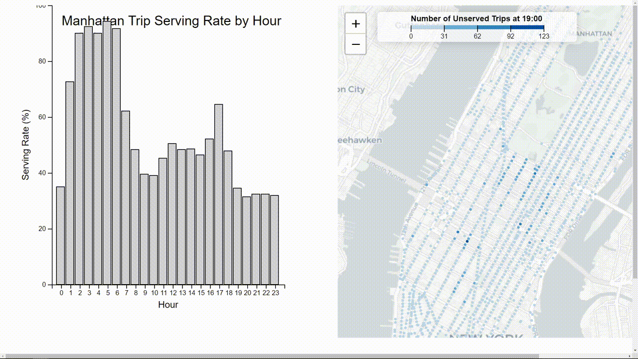
Construct a bar plot
-
Plot "fail to serve" points to Manhattan map
- The serve rate is at highest at "very early" in the morning (1-6am) and lowest in the afternoon (7pm-11:59pm):
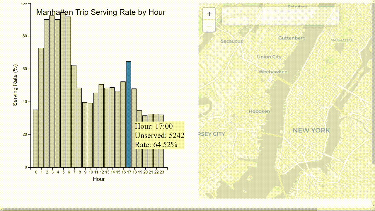
- The serving rate decreased significantly after(5pm) may because of the increasing of traffic at that time:
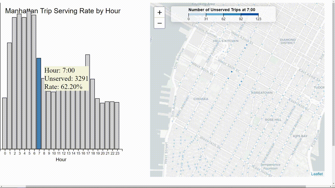
- The area with lowest serving rate is 34th street which always have the highest number of unserved trip: