| image | text endpoint | svg endpoint | data source | description |
|---|---|---|---|---|
 |
txt | svg | govdata.de | Info box on start page |
 |
txt | svg | govdata.de/web/guest/daten | Data counter on data page |
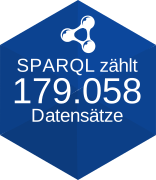 |
txt | svg | govdata.de/web/guest/sparql-assistent | Result of the SPARQL query SELECT (COUNT(?dataset) AS ?datasets) WHERE { ?dataset a dcat:Dataset . } |
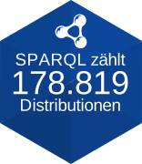 |
txt | svg | govdata.de/web/guest/sparql-assistent | Result of the SPARQL query SELECT ?datasets ?distributions (?distributions / ?datasets AS ?averageDistributionsPerDataset) WHERE {{ SELECT (COUNT(?dataset) AS ?datasets) (SUM(?distributionsPerDataset) AS ?distributions) WHERE {{ SELECT ?dataset (COUNT(?distribution) AS ?distributionsPerDataset) WHERE { ?dataset a dcat:Dataset . ?dataset dcat:distribution ?distribution . } GROUP BY ?dataset }}}} LIMIT 100 |
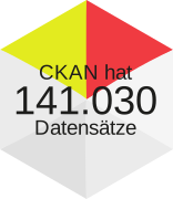 |
txt | svg | ckan.govdata.de/api/3/action/package_list | Length of the dataset list on CKAN endpoint |
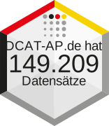 |
txt | svg | ckan.govdata.de/catalog.rdf | Total items count of pagination info in DCAT-AP.de endpoint and data counter on this page: https://ckan.govdata.de/dataset/ |
 |
txt | svg | data.europa.eu/data/datasets?catalog=govdata | Data counter for GovData on EU data portal |
 |
txt | svg | data.europa.eu/catalogue-statistics/CurrentState | Data counter for GovData on the EU data portal statistic page (updated monthly) |
| https://ckan.govdata.de/api/3/action/package_search?rows=1&start=0 |
A monitoring dashboard: https://opendata.guru/govdata/index.html
The OLD OpenAPI description: /openapi.yaml . Use NEW OpenAPI documentation: https://opendata.guru/govdata/api.html
And OLD service endpoints:
- https://opendata.guru/govdata/service/artery.php
- https://opendata.guru/govdata/service/get-and-store-ckan-organizations.php
- https://opendata.guru/govdata/service/get-and-store-ckan-dataset-counts.php
- https://opendata.guru/govdata/service/get-and-store-systems.php
- https://opendata.guru/govdata/service/create-map.php
- https://opendata.guru/govdata/service/create-monitoring.php
What happens at night?
The script service/artery.php is executed automatically every 2 minutes. It can either be started locally via a cron job or using an online service like cron-job.org.
| Order | Level | Asset | Task |
|---|---|---|---|
| 0 | root | void | |
| 1 | ckan-organizations | ❌ get-and-store-ckan-organizations.php | write file /assets/data-YEAR/YEAR-MONTH-DAY-organizations.json |
| 2 | ckan-dataset-counts | ❌ get-and-store-ckan-dataset-counts.php | write / append in file /assets/data-YEAR/YEAR-MONTH-DAY-organizations.json |
| 3 | systems | ❌ get-and-store-systems.php | write file /assets/data-YEAR/YEAR-MONTH-DAY-systems.json |
| 4 | providers | 🆕 api/cronjob/cronjob-providers.php | write file /api-data/temp-YEAR/YEAR-MONTH-DAY-providers.json |
| 5 | monitoring-old | ❌ create-monitoring.php | write file /assets/monitoring-YEAR/YEAR-MONTH-DAY.json |
| 6 | monitoring | 🆕 api/cronjob/cronjob-monitoring.php | write file /api-data/monitor-date/YEAR-MONTH/monitor-YEAR-MONTH-DAY.json |
| 7 | create-map | 🆕 api/cronjob/cronjob-map.php | write file /assets/map-YEAR/YEAR-MONTH-DAY-map.geojson |
| 8 | hvd | 🆕 api/cronjob/cronjob-hvd.php | write file /api-data/temp-YEAR/YEAR-MONTH-DAY-hvd.json |
| 9 | insights | 🆕 api/cronjob/cronjob-insights.php | write file /api-data/temp-YEAR/YEAR-MONTH-DAY-insights.json |
Die hier angebotenen Geodaten stehen über Geodatendienste gemäß der Open Data Datenlizenz Deutschland – Namensnennung – Version 2.0 geldleistungsfrei zum Download und zur Online-Nutzung zur Verfügung. Insbesondere hat jeder Nutzer den Quellenvermerk zu allen Geodaten, Metadaten und Geodatendiensten erkennbar und in optischem Zusammenhang zu platzieren. Veränderungen, Bearbeitungen, neue Gestaltungen oder sonstige Abwandlungen sind mit einem Veränderungshinweis im Quellenvermerk zu versehen. Quellenvermerk und Veränderungshinweis sind wie folgt zu gestalten. Bei der Darstellung auf einer Webseite ist der Quellenvermerk mit der URL "http://www.bkg.bund.de" zu verlinken. © GeoBasis-DE / BKG (Jahr des letzten Datenbezugs) © GeoBasis-DE / BKG (Jahr des letzten Datenbezugs) (Daten verändert)
- start with GovData (or data.europe.eu ?)
- get a list of all organisations (data providers)
- the CKAN endpoint for organisations count the datasets
- classify the data provider per hand (other portal, municipal unit, museum, ...)
- go to the origial portal / website and count the datasets (if possible)
- get a list of all organisations ...
- check for recursion!!!
Go to open data portal SPARQL query page:
- learn SPARQL https://data.europa.eu/de/about/sparql
- https://data.europa.eu/data/sparql?locale=en
- endpoint
https://data.europa.eu/sparql
- endpoint
Run some queries:
List 10 datasets
PREFIX dcat: <http://www.w3.org/ns/dcat#>
PREFIX odp:  <http://data.europa.eu/euodp/ontologies/ec-odp#>
PREFIX dct: <http://purl.org/dc/terms/>
PREFIX xsd: <http://www.w3.org/2001/XMLSchema#>
PREFIX foaf: <http://xmlns.com/foaf/0.1/>

SELECT * WHERE { ?d a dcat:Dataset } LIMIT 10
Get a list of all catalogues on data.europa.eu
PREFIX dcat: <http://www.w3.org/ns/dcat#>
PREFIX dct: <http://purl.org/dc/terms/>
PREFIX rdfs: <http://www.w3.org/2000/01/rdf-schema#>
PREFIX skos: <http://www.w3.org/2004/02/skos/core#>
PREFIX rdf: <http://www.w3.org/1999/02/22-rdf-syntax-ns#>
PREFIX xsd: <http://www.w3.org/2001/XMLSchema#>

SELECT DISTINCT ?parentCatalog ?catalog ?title ?spatial ?typePublisher ?homepage ?email
WHERE {?catalog ?p ?o.
FILTER (?o=<http://www.w3.org/ns/dcat#Catalog>)
OPTIONAL {?catalog <http://purl.org/dc/terms/title> ?title}
OPTIONAL {?parentCatalog <http://purl.org/dc/terms/hasPart> ?catalog}
OPTIONAL {?catalog <http://purl.org/dc/terms/spatial> ?spatial.}
OPTIONAL {?catalog <http://purl.org/dc/terms/publisher> ?publisher.
OPTIONAL {?publisher <http://xmlns.com/foaf/0.1/homepage> ?homepage.}
OPTIONAL {?publisher <http://xmlns.com/foaf/0.1/mbox> ?email.}
OPTIONAL {?publisher <http://purl.org/dc/terms/type> ?typePublisher.}
}
}
ORDER BY DESC (?spatial)
Publishers by catalogue
PREFIX dcat: <http://www.w3.org/ns/dcat#>
PREFIX odp: <http://data.europa.eu/euodp/ontologies/ec-odp#>
PREFIX dct: <http://purl.org/dc/terms/>
PREFIX xsd: <http://www.w3.org/2001/XMLSchema#>
PREFIX foaf: <http://xmlns.com/foaf/0.1/>

SELECT DISTINCT ?publisher ?publisherName ?publisherLabel
WHERE {
<http://data.europa.eu/88u/catalogue/govdata> a dcat:Catalog;
dcat:dataset ?datatsetURI.
?datatsetURI dct:publisher ?publisher.
OPTIONAL {?publisher foaf:name ?publisherName}
OPTIONAL {?publisher skos:prefLabel ?publisherLabel}
}
LIMIT 25
**Show HVD datasets
Bsp. für keyword = Georaum (insgesamt haben 375 Datensätze dieses Schlüsselwort)
https://gdk.gdi-de.org/gdi-de/srv/eng/csw ?request=GetRecords &version=2.0.2 &service=CSW &resultType=results &outputSchema=http://www.isotc211.org/2005/gmd &NAMESPACE=xmlns(gmd=http://www.isotc211.org/2005/gmd) &typeNames=gmd:MD_Metadata &CONSTRAINTLANGUAGE=FILTER &CONSTRAINT_LANGUAGE_VERSION=1.1.0 &elementSetName=full &startPosition=1 &maxRecords=10 &CONSTRAINT=%3Cogc:Filter%20xmlns:ogc=%22http://www.opengis.net/ogc%22%20xmlns:apiso=%22http://www.opengis.net/cat/csw/apiso/1.0%22%20xmlns:gmd=%22http://www.isotc211.org/2005/gmd%22%3E%3Cogc:And%3E%20%3Cogc:PropertyIsEqualTo%3E%20%3Cogc:PropertyName%3Eapiso:type%3C/ogc:PropertyName%3E%20%3Cogc:Literal%3Edataset%3C/ogc:Literal%3E%20%3C/ogc:PropertyIsEqualTo%3E%20%3Cogc:PropertyIsEqualTo%3E%20%3Cogc:PropertyName%3Eapiso:subject%3C/ogc:PropertyName%3E%20%3Cogc:Literal%3EGeoraum%3C/ogc:Literal%3E%20%3C/ogc:PropertyIsEqualTo%3E%20%3C/ogc:And%3E%3C/ogc:Filter%3E
<ogc:Filter xmlns:ogc="http://www.opengis.net/ogc" xmlns:apiso="http://www.opengis.net/cat/csw/apiso/1.0" xmlns:gmd="http://www.isotc211.org/2005/gmd">ogc:And ogc:PropertyIsEqualTo ogc:PropertyNameapiso:type</ogc:PropertyName> ogc:Literaldataset</ogc:Literal> </ogc:PropertyIsEqualTo> ogc:PropertyIsEqualTo ogc:PropertyNameapiso:subject</ogc:PropertyName> ogc:LiteralGeoraum</ogc:Literal> </ogc:PropertyIsEqualTo> </ogc:And></ogc:Filter>
<ogc:Filter xmlns:ogc="http://www.opengis.net/ogc" xmlns:apiso="http://www.opengis.net/cat/csw/apiso/1.0" xmlns:gmd="http://www.isotc211.org/2005/gmd"> ogc:And ogc:PropertyIsEqualTo ogc:PropertyNameapiso:type</ogc:PropertyName> ogc:Literaldataset</ogc:Literal> </ogc:PropertyIsEqualTo> ogc:PropertyIsEqualTo ogc:PropertyNameapiso:subject</ogc:PropertyName> ogc:LiteralGeoraum</ogc:Literal> </ogc:PropertyIsEqualTo> </ogc:And> </ogc:Filter>
Mapping https://github.com/geopython/pycsw/blob/70f1a19f764757a459501ae59f75982a50a14acb/pycsw/plugins/profiles/apiso/apiso.py#L65
- 'apiso:Type' -> 'xpath': 'gmd:hierarchyLevel/gmd:MD_ScopeCode'
- 'apiso:Subject' -> 'xpath': 'gmd:identificationInfo/gmd:MD_Identification/gmd:descriptiveKeywords/gmd:MD_Keywords/gmd:keyword/gco:CharacterString|gmd:identificationInfo/gmd:MD_DataIdentification/gmd:topicCategory/gmd:MD_TopicCategoryCode'
Result: csw:GetRecordsResponse csw:SearchResults gmd:MD_Metadata gmd:hierarchyLevel <gmd:MD_ScopeCode codeList="https://standards.iso.org/iso/19139/resources/gmxCodelists.xml#MD_ScopeCode" codeListValue="dataset">dataset</gmd:MD_ScopeCode> gmd:identificationInfo gmd:MD_DataIdentification gmd:descriptiveKeywords gmd:MD_Keywords gmd:keyword gco:CharacterStringGeoraum</gco:CharacterString>
Ansonsten müsstest du den Term „Georaum“ dann für die anderen fünf Kategorien jeweils austauschen.
Die HVD-Kennzeichnung verdient diesen Namen aber erst, wenn auch der Thesaurus angegeben ist wie vorgesehen.
csw:GetRecordsResponse csw:SearchResults gmd:MD_Metadata gmd:identificationInfo gmd:MD_DataIdentification gmd:descriptiveKeywords gmd:MD_Keywords gmd:thesaurusName gmd:CI_Citation gmd:title gco:CharacterStringHigh-value dataset categories</gco:CharacterString>
- https://www.ogc.org/de/publications/standard/filter/
- https://docs.geoserver.org/main/en/user/filter/filter_reference.html
- InGrid CSW Schnittstelle:
- Die CSW-Schnittstelle bietet Zugang zur InGrid-Suche über die OGC CSW 2.0.2 AP ISO 1.0 Schnittstellenspezifikation
- https://www.ingrid-oss.eu/5.2.0/components/interface_csw.html
- https://www.ogc.org/de/publications/standard/cat/
- https://redmine.gdi-de.org/projects/gdi-de-registry/wiki/Tipps
- https://schemas.opengis.net/csw/2.0.2/profiles/apiso/1.0.0/apiso.xsd
- API description for Catalogue Service for the Web 2.0.2 (CSW)
Iteration 2 (only 1 dataset):
Iteration 3 (replace apiso:Subject with xpath):
- CSW service
- Portal
- GeoNetwork Api Documentation (beta)
- https://gdk.gdi-de.org/gdi-de/doc/api/
- https://gdk.gdi-de.org/gdi-de/srv/v2/api-docs
- https://gdk.gdi-de.org/geonetwork/srv/api/0.1/records (too big to get a valid request)
- INSPIRE
- INSPIRE theme, artical from Jesper: https://open-north.de/blog/2023-07-24_inspire_abkuerzungen/
- INSPIRE theme registry: https://inspire.ec.europa.eu/theme
- Building functions
- Artical from Jesper: https://open-north.de/blog/2022-09-04_geobasisdaten_nutzung/
- Code lists by ADV: https://repository.gdi-de.org/schemas/adv/citygml/Codelisten/BuildingFunctionTypeAdV.xml