Rashard Kelly NasaJpl MRO JUNO iSS ALt - github.com/kellyrashardiman/kellyrashardiman.github.io + homepage alt - kellyrashardiman.github.io


Remotely Estimating Total Suspended Solids Concentration in Clear to Extremely Turbid Waters Using a Novel Semi-Analytical Method - Link @blackgirlscode @blueorigin @thespacedevs @rocketlab dsnnow

Los Angeles County!
MAPPiNG @CityOfLosAngles Trees @StateOfCalifornia
     ___    _____     ___
   /_ /|  /____/ \  /_ /|       Horizons On-line Ephemeris System v4.98d
   | | | |  __ \ /| | | |       Solar System Dynamics Group
___| | | | |__) |/  | | |__     Jet Propulsion Laboratory
/___| | | |  ___/    | |/__ /|   Pasadena, CA, USA
|_____|/  |_|/       |_____|/
Governor Gavin Newsom delivers his 2026 State of the State address
<iframe width="560" height="315" src="https://www.youtube.com/embed/mppnxokNmOc?si=La4gAmuGfXVMQvhq" title="YouTube video player" frameborder="0" allow="accelerometer; autoplay; clipboard-write; encrypted-media; gyroscope; picture-in-picture; web-share" referrerpolicy="strict-origin-when-cross-origin" allowfullscreen></iframe>Clean Energy Map of California Energy Sources <~ @la-county-isd Holly Mitchell : Kathy Barger @blackgirlscode if u got downtime share with your responsible family memebers


@asfadmin eatonCanyon @la-county-isd https://build.ca.gov/ build.ca.gov/
@nasa-jpl @swot-community @NAsa-OpenScapes DamBusters 2026 - watch
@la-countyisd @LACMTA @cityoflosangeles MAYOR BASS ? SuperVisor Mitchell someone from sanfrancisco is in my account @github @nasa-jpl @emit-sds @nasa-pds @blackgirlscode
Long Beach 205.154.246.79
active
Your current session
Seen in US
San Francisco 107.77.214.63
active
Last accessed on Jan 07, 2026
Seen in US
@la-county-isd https://build.ca.gov/ build.ca.gov/

Sync issues @StateOfCalifornia ?
@stateofcalifornia i think @youtube got slowed down ... my best ebonics @nasa-jpl @emit-sds @whitehouse
https://www.youtube.com/watch?v=mppnxokNmOc @usgs @cityoflosangeles @la-county-isd Janic Hahn
 @cityoflosangeles @la-county-isd Ms Mitchell / Ms Bass ?
Asked a woman on a date?
@cityoflosangeles @la-county-isd Ms Mitchell / Ms Bass ?
Asked a woman on a date?


Lindsey H oravath
Rob Bonta Sally LBrahim associate-justice-leondra-r-kruger
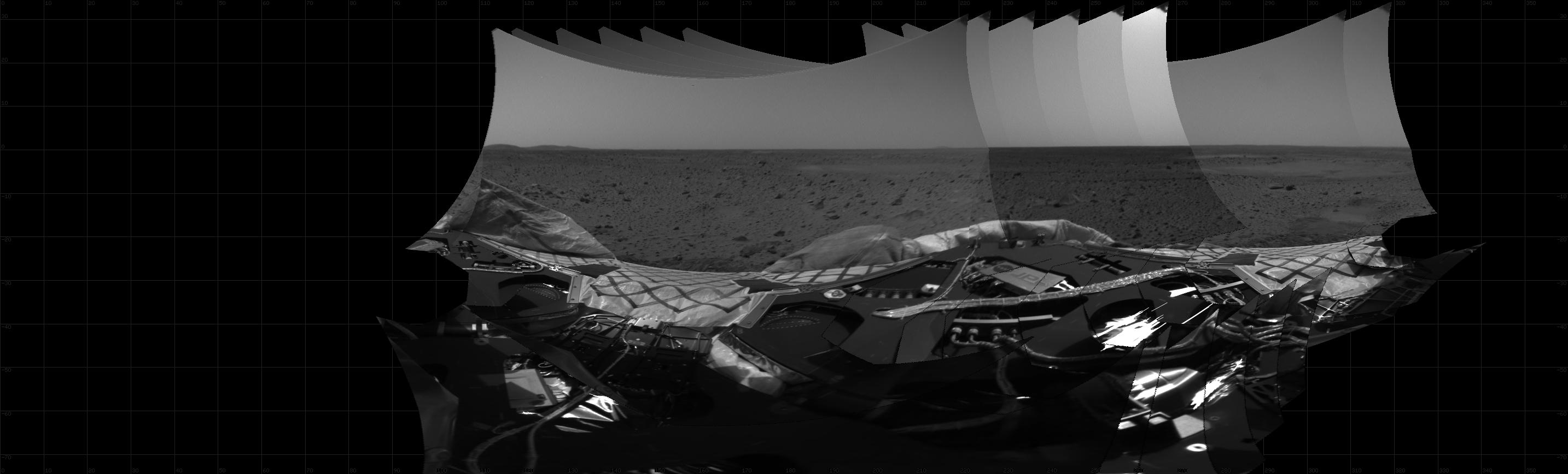
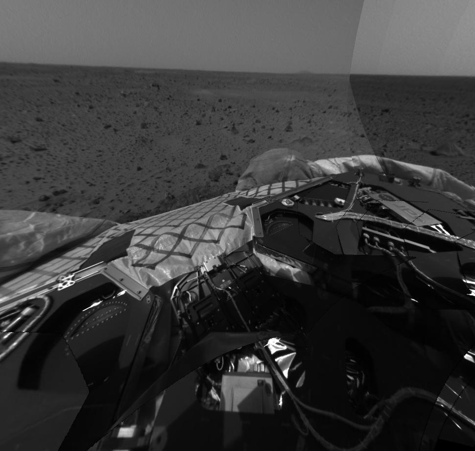
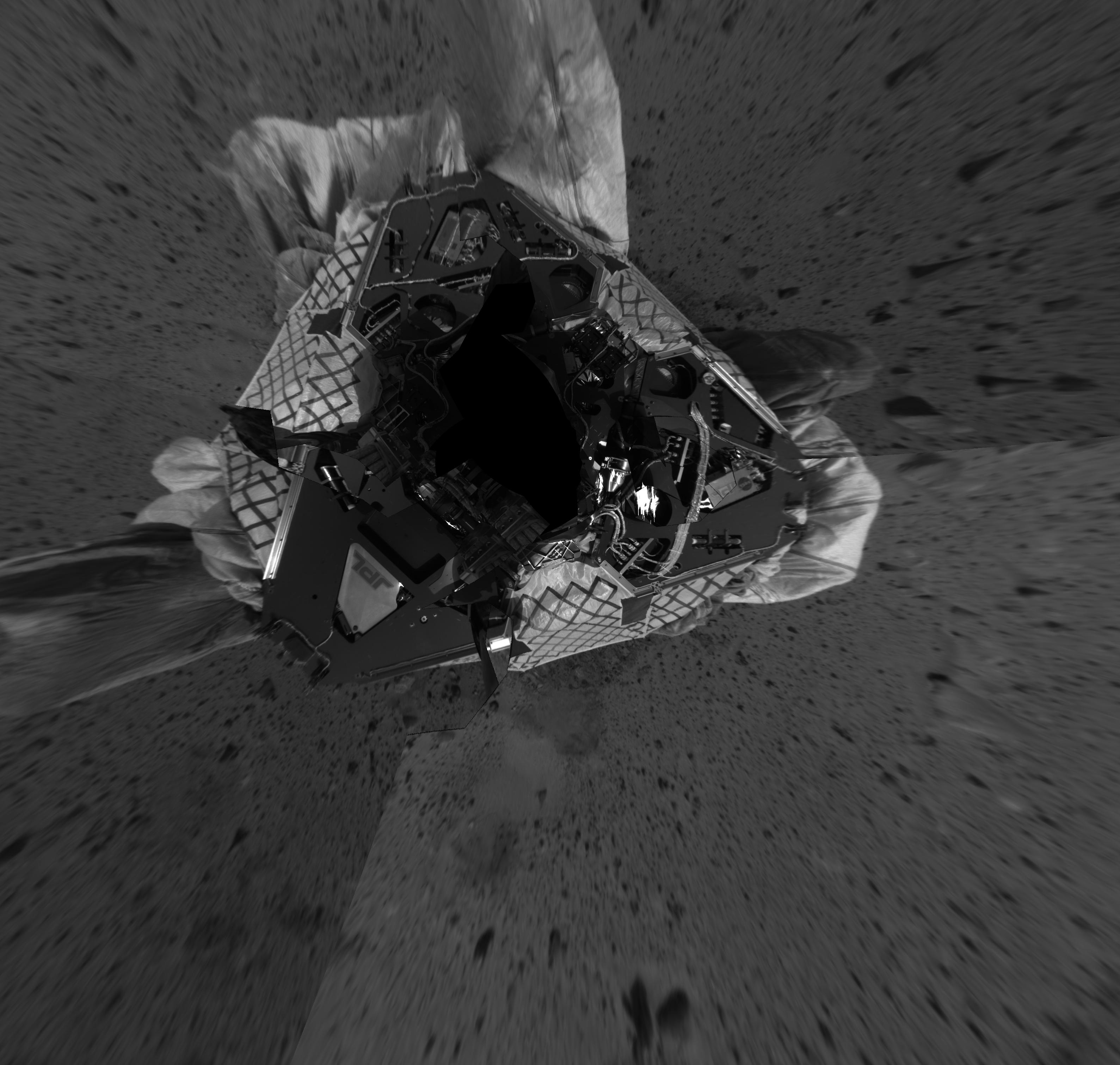
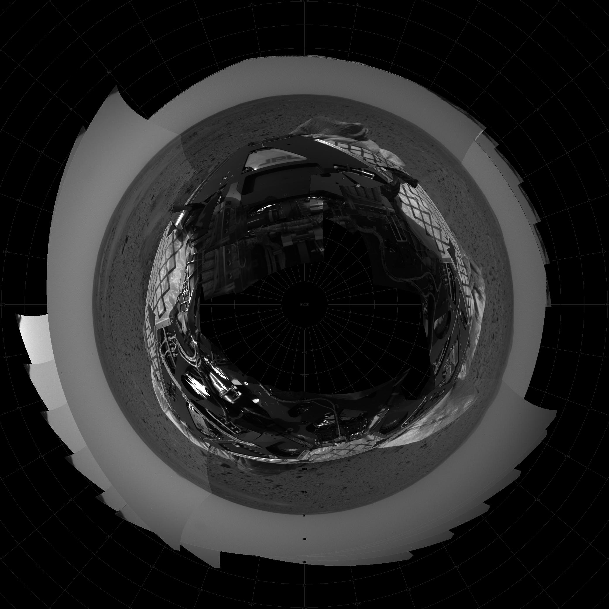
@nasa-jpl it should be on inthe cafeteria @boeing can someone pass him this Archive or his support stafff, im struggling man! Mars Geology Imaging + ELNiNO ANOMOLY Gifs link @lacounty-isab @osmlab @usgs @LACountyDPH who is MarthaCooper in this era CLiCKHERE
Gavin Newsome Live @StateofCalifornia : DeepSpaceNetowrk
: [NASA Goldstone Visitor Center] Tour

who do you stand for . . . @blackgirlscode i have more faith at the moment re:SpecialEducation @newshour

<img alt="image" src="https://github.com/user-attachments/assets/d3ea613b-bd23-4e01-aef5-d2f458033055" />

@Cityoflosangeles @la-county-isd @UsNAVY @Code-dot-mil re: Seal Beach Link ///////// /archive/2025/358/LC08_L1TP_041037_20141124_20200910_02_T1/ Total Suspended Solids (TSS) meaning @NASA-GISS @Blackgirlscode @Cityoflosangeles @ls-county-isd


@emit-sds @podaac @nasa-jpl @nasa-develop @tesla @datadesk @newshour @washingtonpost #GASBUDDYLATRiCE how u doin oh its Latrice... OhKaaay . . .
Governor Gavin Newsom delivers his 2026 State of the State address
<iframe width="560" height="315" src="https://www.youtube.com/embed/mppnxokNmOc?si=La4gAmuGfXVMQvhq" title="YouTube video player" frameborder="0" allow="accelerometer; autoplay; clipboard-write; encrypted-media; gyroscope; picture-in-picture; web-share" referrerpolicy="strict-origin-when-cross-origin" allowfullscreen></iframe>


@la-county-isd @nasa-jpl @blackgirlscode here's a few pics of vintage LosAngeles Steve Ackley Public Affairs Specialist California Water Science Center Email : hackley@usgs.gov Phone : 916-532-7602 A monitoring Station On the LA-AQUEDUCT appears broken! And it may have been vandalism because the river is out of control. Rogue Security uses it to wash out destituted sex tourist partying down there https://waterdata.usgs.gov/monitoring-location/USGS-11103000/#dataTypeId=daily-00060-0&period=P1Y&showFieldMeasurements=true < Broken Monitoring Station
- MAP Staff @usgs @la-county-isd Mrs Bass Mrs Mitchell Maxine Waters @sduong97 hi can you tell them about this BrokenMonitoringStation ? -rashard
-Rashard @nasaEArthdata sup GasBuddyLAtrice i hope u get this Normani im assuming you working still... @blackgirlscode


naming conventions 0000_firedata_virtiserv_SimpleScanStation20260105145139-03.png 05-Jan-2026 23:34 5.2M
0000_firedata_virtiserv_SimpleScanStation* LOCATED Archive.org CLiCKhere @Cityoflosangeles @la-county-isd i emailed details to @USGS for todays MeetingAgendaiTem22 <~ @nasa-jpl hi @blackgirlscode hope yall ok ill get instructions at some point gals
Participate by Phone: (213) 306-3065
Access code: 2530 234 0269 Password: 2672026
To Listen by Telephone Only:
Call: (877) 873-8017 Access Code: 111111 (English) 222222(Espanol)


Worldview Opera Data Set, Los Angeles Land Disturbances Dec202025
https://worldview.earthdata.nasa.gov/?v=-118.86053276977968,33.85069318585635,-117.98037344144863,34.287563935803995&l=Reference_Labels_15m(hidden),Reference_Features_15m(hidden),Coastlines_15m(opacity=0.67),VIIRS_NOAA21_Thermal_Anomalies_375m_Day,VIIRS_NOAA21_Thermal_Anomalies_375m_All,VIIRS_NOAA20_Thermal_Anomalies_375m_Night,VIIRS_NOAA20_Thermal_Anomalies_375m_Day,VIIRS_NOAA20_Thermal_Anomalies_375m_All,MODIS_Aqua_Thermal_Anomalies_Day,MODIS_Aqua_Thermal_Anomalies_All,MODIS_Combined_Thermal_Anomalies_All,OPERA_L3_DIST-ALERT-HLS_Color_Index(disabled=0),HLS_L30_Nadir_BRDF_Adjusted_Reflectance(hidden),HLS_S30_Nadir_BRDF_Adjusted_Reflectance,Land_Water_Map&lg=true&tr=land_disturbance&s=-118.2433,34.0522&t=2025-12-20-T05%3A00%3A00Z
@LACountyDPH @CityOfLosAngeles @DataDesk @NAsa-jpl @la-county-isd Holly Mitchell / Karen Bass

Re: @NASAJPL LosAngeles> "Santa Fe High ScHool LAnd Disturbance*" I dont know who to tell.... i just saw it on the map , I emailed people about MAyfair and bumped into a sending limit, i been being followed so i cc a lot of people because i know someone that cares about me will get it via relay, im exiled for reading an book by Mr Franz a Jehovhas Witness Apostate called Crisis OF Conscience and my 1st spouse work for playboy, the girl she set me up with got kidnapped and converted vixen, and the new girl like a flighty possum at the fbi and i need to make sure im visible so she dont get a bad story, that pretty will turn ugly quick! @la-county-isd @lacounty-isab Karen Bass / Holly Mitchell, i only talk to you becasue you black and i need help... @blackgirlscode hi -rashard @nasajpl Rio San Gabriel : HOMEPAGE
DownyUnifiedAnnualReport Los Angeles County Departments @nasa-jpl @usgs Land disturbance Santafe highschool Worldviewlink


@CityOfLosAngeles @nasa-JPL Kathey BerGer Hilda Solis Karen Bass Holly Mitchell @StateOfCalifornia #Eaton Canyon Land Disturbance Link links palisadesFirefootprint

@blackgirlscode @cityoflosangeles

NBC News 8hrs of coverage of rushing river - watch Thermal
The rain let up around 2am downtown. Riding into longbeach there was a thick low fyling cloud that gave us a foggy ride in. The ComptonCreek is now muddy and the Los Angeles River is about two feet lower and the water is flowing slower . . . @SWOT-community hi I have to keep up with the river because @LACMTA sometimes has water on the tracks and M_R_O assigned me to the NasaFireDept, and gave me a NasaEarthdataLogin and guidance to explore FireSensingTech and this year i made great contributions to The Local Newspapers with forensic data for housing the homeless in safe habitats and diagnosing brush fire files: ComtonCreek 12/27 ; LosAngelesRiver 12/27 -rashard @nasa-jpl @weather-gov @cityoflosangeles @la-county-isd @blackgirlscode i sent normani a letter on @tumblr ... @howard-university-web-services I hope im not bugging you, she is a girl, latrice that is and everything will stop the bugabooing and everything. some girl from her pretty girl tribe got kidnapped in atlanta an they playing some sort of evil board game to get her back and some ppl identity clear for some people that no one can find ... I recently forked @meta facebookresearch/EgoBlur, I have to look at the deeper software to figure out how ppl thinking on Facebook, any platoform that is, but this really caught my attention
ThisRepositoryContains a command-line interface(CLI) that can detect and blur out faces and license plates(PII) from images and videos. The CLI takes an image or video file as input, runs an anonymization algorithm on it, and writes the blurred output to a specified path. @nasa-jpl @blackGirlsCode im scared of this one so im forking it! @NASA-PDS
anyway looking at @usgs WaterDashBoard The dam output dropped, i have to keep moving, i hope to track this storm across the missisippi , whats a cloud made up of, its a long term thing... i just dont want to be slammed with due dates man

Thermal Anomalies - Firms : ThermalAnomolies

@cbs-news-data the naming convention for the river footage i captured in the last 18hrs or so is https://ia600307.us.archive.org/10/items/commitmentmaintenance/0000000000_oORivercheKsWaterReport_rashard_NASAJPL_virtiserV_hi_latricE_waterLevelsdown2feet*
Websites To Explore Water and Power Associates Informing the Public about Critical Water and Energy Issues facing Los Angeles and California About The Website Your gateway to L.A.'s water and power history and current issues. Water and Power Associates' website is a trusted, independent resource for anyone interested in the history and current issues of water and energy in Southern California. It offers:
◆ Objective, non-partisan information on water and power
◆ A vast digital archive of photographs and historical documentation
◆ Educational tools for researchers, students, and civic planners
The website serves as both an advocacy and preservation platform, ensuring that Southern California's infrastructure story is remembered—and that future policy is shaped with insight. @podaac @nasa-jpl https://waterandpower.org/index.html
Los Angeles Aqueduct Built in 1913, the Los Angeles Aqueduct provides critical water to millions of people. Link : Link https://www.ladwp.com/who-we-are/water-system/los-angeles-aqueduct
Water_for_L.A._Brochure_English
L.A. Aqueduct Conditions Reports
clicking on a station will display a chart of the last five days.
HISTORY OF THE LOS ANGELES RIVER
@newshour Application User Workshop 2017 Report

- bonus 1940s LOS ANGELES & HOLLYWOOD CALIFORNIA
- HOME MOVIE CHINATOWN OLVERA STREET XD95595
- LinK


@stateofCalifornia @cityoflosangeles karen bass / holly mitchell i made a simple water report with an overview of the dam discharge water report! @nasa-jpl @weather-gov @noaa-gov -rashard @nasa-jpl @weather-gov @cityoflosangeles @la-county-isd CLicKHere To Watch VideoFile / Play on Archive.org
map ::: CountyView : StreetHeatMap

San Gabriel River Mouth [1] [2]

Cops in Los Angeles County, CA 1992 : The Real LAPD - Episode 11- Super CopAP006302 : Los Angeles in the 1940s. "Vintage Los Angeles" Hollywood : SOUTHERN CALIFORNIA HOLIDAY 1940s TRAVELOGUE SANTA FE RAILROAD 44214

Map of resivoirs and settlements and dams, its not as complete as @usgs WaterDashboard @la-county-isd

Compton Creek MAP @usgs @nasa @nasa-jpl @googleearth Map


Sanbernadino
fsac 1a34758 https://hdl.loc.gov/loc.pnp/fsac.1a34758


647am I rode through the Santa Fe dam on the train @usgs large reservoirs were full but not all of them , The water rate monitor looks accurate look at the data - the 🗺️ map 🗾
Earlier ~430 I checked the river crossover near Union Station The water was lower than it was when I visited earlier, I could see the concrete but it was still feeling fast and I would have called a shallow if not for the middle channel See photo more @blackgirlscode Virtiserv earthdataRashard ~thakasartu, ~530am as I crossed the bridge little Chinatown and highland Park over the river it was high and flowing strongly from the mountains -rashard @nasa-jpl @weather-gov @cityoflosangeles

@nasa
Rashard Kelly NasaJpl MRO JUNO iSS ALt - github.com/kellyrashardiman/kellyrashardiman.github.io + homepage alt - kellyrashardiman.github.io
DigitalMass Norwich Cathedral - Midnight Mass / Midnight Mass at Westminster Abbey | Wednesday 24th December @Cia my chrismas eve @blackgirlscode in the library shivering
@blackgirlscode https://ieeexplore.ieee.org/document/9969974


NewSkills : coalace for robotic story boarding


@podaac @nasa-jpl @developmentseed @landsat the background for my iss pages site is gone and the hosting changed along with the path to the file
background: url(https://landsat.gsfc.nasa.gov/wp-content/uploads/2013/12/San_Fran_old_432.jpg) no-repeat 0 0 fixed; background-size: cover;\ background: url(https://landsat.gsfc.nasa.gov/wp-content/uploads/2013/12/San_Fran_new_432.jpg) no-repeat 0 0 fixed; @cityoflosangeles @nasa @blackgirlscode
html {
font-size: 1rem;
 background-size: 100%;


       margin: 0px;
     padding: 0px 0 20px 0px;
     font-size:100%;

   /* background-image: url("https://fgbg.art/static/svc_telephonePoles-7517ec4812af7eaa7b36b929dc045d95.gif"); sVC telephone poles */
   /* background-image: url("https://fgbg.art/static/mvc_newYork-8a30ed825143d36b528b5f9826ed9fe3.gif"); spiderman mvc */
   /*background-image: url("https://fgbg.art/static/motw_terry2-e7bbcf53ab92406bdbcb77a42546f5f1.gif");  terry bogard*/
   /*  background-image: url("https://fgbg.art/static/mvc_drWilyBase-1d2ec60216b5dfe2cfd1df78ee3fa5ec.gif"); */
    /* background-image: url("https://fgbg.art/static/mvc_newYork-8a30ed825143d36b528b5f9826ed9fe3.gif"); */
    /* background-image: url("https://fgbg.art/static/aof3_library-3f491fd56f7a36828c14e5b3c02c2327.gif"); AoF3 Library */
   /* background-image: url("https://fgbg.art/static/motw_downtown-cb25d556c94dde722c37d5cad1c924a6.gif"); dr wiley mvc */
   /* background: url(https://raw.githubusercontent.com/ricoThaka/ricothaka.github.io/master/assets/MOSHED-2024-3-4-13-41-24.jpg) no-repeat 0 0 fixed; */
   background: url(https://landsat.gsfc.nasa.gov/wp-content/uploads/2013/12/San_Fran_old_432.jpg) no-repeat 0 0 fixed;
   background-size: cover;
    line-height: 1.5;
    -webkit-background-size: cover;
   -moz-background-size: cover;
   -o-background-size: cover;
   background-size: cover;
   height: 100vh;
   width: 100vw;
   column-fill: balance;
   word-break: break-all;
   }
section {

  display : block;
  flex-wrap: wrap;
  border-radius: 0px 0px 0px 0px;
  margin-top: 0px;
width: 90vh;
padding: 0px;
  margin-bottom: 40px;
  margin-right: auto;
  margin-left: auto;
  margin-top: -195px;
  line-height: 1.5;
/* opera does not like 'margin:20px auto' */
/* background: #666; */
border: 1px solid white;
background: url(https://landsat.gsfc.nasa.gov/wp-content/uploads/2013/12/San_Fran_new_432.jpg) no-repeat 0 0 fixed;
/* https://developer.mozilla.org/en-US/docs/Web/CSS/background-size */
background-size: cover;
margin-right: auto;
margin-left: auto;
/* background: url(https://mars.nasa.gov/mars2020-raw-images/pub/ods/surface/sol/01046/ids/edr/browse/rcam/RRF_1046_0759804806_506ECM_N0495338RHAZ02420_01_295J01_800.jpg) no-repeat 0 0 fixed; */
/* https://developer.mozilla.org/en-US/docs/Web/CSS/background-size */

text-align:left;
/* part 2 of 2 centering hack */
voice-family: "\"}\"";
voice-family:inherit;


box-shadow: rgba(255,255,255, 0.4) 5px 5px, rgba(255,255,255, 0.3) 10px 10px, rgba(255,255,255, 0.2) 15px 15px, rgba(255,255,255, 0.1) 20px 20px, rgba(255,255,255, 0.05) 25px 25px;font-family: 'Martian Mono',-apple-system, Ariel, Verdana;
/* color: #c9ff23;  */
overflow-y: auto;
}


![]()


@blackgirlscode @nasa-jpl
![]()
Emit EMIT-Data-Resources Public forked from nasa/EMIT-Data-Resources
ECOSTRESS-Data-Resources
Public
forked from nasa/ECOSTRESS-Data-Resources
![]()

Download as .zip Download as .tar.gz View on GitHub #./HoleToAnotherUniverse/mybinder/3.10.0CompilingAtThisTimE! : Mission Objectives NASA’s Mars Reconnaissance Orbiter searches for evidence that water persisted on the surface of Mars for a long period of time. ReadMore Rashard Kelly NasaJpl MRO JUNO + iSS BinderBuild StatusGem Versionemit genesisReturn
California Linux init 0 https://thakarashard.github.io /linux
jekyll.version 3.10.0 OBJECT = MISSION MISSION_NAME = “JUNO” OBJECT = MISSION_INFORMATION MISSION_START_DATE = 2011-08-05 MISSION_STOP_DATE = NULL CATFiLE @stateofcalifornia @cityoflosangeles @nasa @nasa-jpl @podaac
Long Beach Public Library City of South Pasadena – Local Government South Pasadena Public Library #AboutJPL https://www.spaceforce.mil/Portals/2/Documents/SF101/ussf_101_glossy_FINAL_e-version.pdf + https://d34w7g4gy10iej.cloudfront.net/video/1912/DOD_107547647/DOD_107547647-1280x720-2765k.mp4 Congressmember Karen Bass Judy Chu St. Francis Center Hollywood Food Coalition ::: NASA Solar System Exploration / NASA/JPL Physical Oceanography Data Center / NASA's Perseverance Mars Rover image
image
Thaka Sartu plz dont block me, if i come im really working Name: Rashard I Kelly Username: rashardkelly Email Address: holetoanotheruniverse40@gmail.com Organization: Mars Reconnocinse Orbiter #NasaJPL #La_CanaDa_FlintRidge Los Angeles County California Country: United States Member Since: 08-24-2024 Last Authentication: 08-21-2025 NASA Jet Propulsion Laboratory NASA’s Europa Clipper Mission ESA - European Space Agency https://rashardgds.github.io/2025/08/16/ECOSTRESSMonitoringplantsfromspace.html Congressmember Karen Bass MIT Technology Review tell Supervisor Holly J. Mitchell something about #RemoteSensing firre Kimberly Bryant, Founder Black Girls CODE i was just reall tell all my pelvic contact thank you for the slumber parties inbetween #SingleDadLife and #DevOpsGrowth - No photo description available. 49m Reply Thaka Sartu NASA/JPL Physical Oceanography Data Center idk who cars but no matter what the NASA - National Aeronautics and Space Administration instructions say i shoukld not work from the main branch and i forked my own Kimberly Bryant, Founder Black Girls CODE 45m Reply Thaka Sartu Kimberly Bryant, Founder Black Girls CODE im being shut down if i mention black girls code is Steve Harvey involved ? if so i need him and so N so in front of my boss Bill Nelson not in a gay chrissette michelle way but like this dude knows me at the U.S. Department of Labor lever NOAA Satellite and Information Service they told me to trak your units, if im out of line #PresidentTrump said United States Space Force is the 6th branch of the military so we are pals, till the bras come off https://d34w7g4gy10iej.cloudfront.net/video/1912/DOD_107547647/DOD_107547647-1280x720-2765k.mp4 <~ thats the thing where he said he had money for everyone in #SpaceOperations United Nations Office for Outer Space Affairs (UNOOSA) its an old whiteman! if i dont have a roof, his business is in jepordy . #NorthAmerica is a legacy that he would be super stupid not to clean up bc he will be listed with ppl like ##CHARLES_KOCH and the pollution in thier #MidwestWake Los Angeles First United Methodist Church i plan to attend #Mr_Byron_Funeral_in_HOLLYWOOD NASA Aeronautics ppl drop hints and #Jose_M_Pi or Gavin Newsom would take my raggedy badge, also with the whiteman thing, they know since blacks were displaced we have issues with holding on to physical objects and replacing my superdope badge is not healthy for theft and robbery jeapordizing #SpaceOPerations and its #TheCyberWorkforce i asked for it, forced my hand at levels NASA Solar System Exploration they were going to teach me how to act and survive, but the bad kids with the color hair divided us, bc they wanted a fellow researcher in the field so i took the #DEVOPSDRESSCODE bc it worked being a #StrugglingSingleFather Maxine Waters please check out this #PDF https://www.spaceforce.mil/Portals/2/Documents/SF101/ussf_101_glossy_FINAL_e-version.pdf the way United States Space Force is outlined i dont have to do anything but obey orders from my team NASA Mars @ NASA Earthdata oh yeah #DSN NASA Space Communications and Navigation oh and that sickly guy that voimited a lot NASASpaceflight.com its a full load Kimberly Bryant, Founder Black Girls CODE and whatever she gave me was what i needed i the moment not to end my life, its the nurturing in that #EastAtlantaStudio for dudes not into nudity like that. I hope Steve Harvey show do ok #iMLocal Councilman Steve G. Hockaday, Esq. and thats #UnixHelpdeskLevel5 im still a young adult but thats porno ranking… something is wrong with how the country judges age, its the breast…. Essence i know what i look like so … whatever you guys poisoned me with to grey my beard idk, i know yall needed help . Lockheed Martin #PROTECTTANYA :#re: #ChildAbduction #Sacrilidge Congressmember Karen Bass ISRO - Indian Space Research Organisation May be an image of 4 people and text 32m Reply Thaka Sartu Department of Homeland Security i dont want you guys to #JehovahsWitnessME i just want you to know im real, and not setting Ms Bass up for a #TreasonusHumiliation International Space Station Tesla the Band Tesla #ELON_MUSK Councilmember Marqueece Harris-Dawson DeKalb County Police Department Keisha Lance Bottoms Georgia Division of Family & Children Services Georgia Bureau of Investigation Gavin Newsom https://d34w7g4gy10iej.cloudfront.net/video/1912/DOD_107547647/DOD_107547647-1280x720-2765k.mp4 Jennifer Siebel Newsom im not trying to hurt your family… im egyptian by bloodline and all the girls got tricked by playboy and not suitible partners biologically, i tell the powerful one on NBC LA shes medicine, thats forever Planned Parenthood Congressmember Karen Bass you gotta interview with Thrasher Magazine if you rock with ELLE i need u to clear me for a partner 11:26 / 13:55 23m Reply Thaka Sartu U.S. Navy U.S. Navy The Secretary of the Navy #This https://www.spaceforce.mil/Portals/2/Documents/SF101/ussf_101_glossy_FINAL_e-version.pdf #PLUS https://d34w7g4gy10iej.cloudfront.net/video/1912/DOD_107547647/DOD_107547647-1280x720-2765k.mp4 Los Angeles County Sheriff’s Department Alaska Satellite Facility Maxine Waters Congressmember Karen Bass ExploreAstro at Caltech/IPAC Clarkston Police Department, Georgia No photo description available. 11m Reply Thaka Sartu WHY SPACE? T here’s no such thing as a day without space. From the GPS receivers on cars and phones, to modern telecommunications, finance, agriculture, and more, space technology has completely permeated the modern way of life. Whether through use of satellites for services, derived technologies, or scientific research, everyone has benefitted from space. A GROWING INDUSTRY Just as the Navy maintains freedom of the seas, the Space Force maintains freedom of space for U.S. activities, both governmental and commercial. Commercial industry is booming, with industries such as low-cost launch, satellite internet, telecommunications, imagery, and even space tourism. In 2024, the “space economy” was valued at $546 billion. With the space domain providing a new engine to the global economy, safe and reliable access to space will impact everyone. INNOVATION AND SCIENCE Space technology has likely woven its way into your everyday life more than you think. Many of the products and tools we use routinely find their origins in space. A few examples are cell phone cameras, solar panels, memory foam, cordless vacuums and power tools, global food safety standards, grooved roadways to reduce accidents, wireless headphones, air purifiers, baby formula, laptops, and much more. NAVIGATION In 2022, a poll identified 93% of American drivers are dependent on GPS to navigate. GPS satellites are operated by the Space Force and instantly triangulate position to give users their pinpoint location anywhere on Earth. This technology has gone on to underpin entire industries including transportation, finance, security, safety, and much more. Without GPS, ATM transactions, self-driving cars, automated agricultural equipment, and many ocean-based operations would come to a screeching halt. Space Force Guardians keep the existing GPS satellite constellation running smoothly and teams of engineers are building the next generation of GPS technology. COMMUNICATION Have you ever used the WIFI while flying on a commercial aircraft? Or perhaps you subscribe to or use satellite radio or TV for constant connection. Every day space is making it easier to connect with friends and family, conduct business, dial 911 in an emergency, and connect to the internet in under-developed or rural areas. The Space Force works with commercial industry to protect those satellites and American’s access to them. 102.3 RadioFree KJLH https://www.spaceforce.mil/Portals/2/Documents/SF101/ussf_101_glossy_FINAL_e-version.pdf 9m Reply Thaka Sartu Long Beach Public Library City of South Pasadena – Local Government South Pasadena Public Library #AboutJPL https://www.spaceforce.mil/Portals/2/Documents/SF101/ussf_101_glossy_FINAL_e-version.pdf + https://d34w7g4gy10iej.cloudfront.net/video/1912/DOD_107547647/DOD_107547647-1280x720-2765k.mp4 Congressmember Karen Bass Judy Chu St. Francis Center Hollywood Food Coalition ::: NASA Solar System Exploration / NASA/JPL Physical Oceanography Data Center / NASA’s Perseverance Mars Rover @podaac @NASA-GISS

 EMiT/ECOSTRESSBinDER
WebSite Analytics rashard_mro @nasa @whitehouse @google @nasa-jpl @deptofdefense @atfweb @dhs-gov @stateofcalifornia good morning + @blackgirlscode
@google my analytics super bad after the last attack @podaac @CityoflosAngeles @stateofcalifornia


doxxed @nasa-jpl ?@nasa @whitehouse @cityoflosangeles please understand im finding out who my responsible relatives are and i work with dangerous equipment and hold secrets that are not for ppl that might be annoying to you, but please forgive yourself because kidnapping confuses everyone @stateofcalifonia gavin newsom rep karen bass


@nasa-jpl working mars on @x
<iframe src="https://archive.org/embed/screen-recording-2024-07-22-11.35.43-am" width="640" height="480" frameborder="0" webkitallowfullscreen="true" mozallowfullscreen="true" allowfullscreen></iframe>
@blackgirlscode tell so and so i did as asked, she has to protect my access, its still my landry basket, its my best

![]()


Pioneer 10 (originally designated Pioneer F) is a NASA space probe launched in 1972 that completed the first mission to the planet Jupiter.[6]
/PDS/CATALOG/ https://hirise-pds.lpl.arizona.edu/PDS/CATALOG/MISSION.CAT PDS_VERSION_ID = PDS3 LABEL_REVISION_NOTE = "2006-07-24, R. Sharrow, initial; 2006-12-15, S. Slavney, reformatted & revised; 2007-07-30, S. Slavney, Aerobraking subphases" RECORD_TYPE = STREAM
OBJECT = MISSION MISSION_NAME = "MARS RECONNAISSANCE ORBITER"
OBJECT = MISSION_INFORMATION MISSION_START_DATE = 2005-08-12 MISSION_STOP_DATE = UNK MISSION_ALIAS_NAME = "MRO" MISSION_DESC = "
The Mars Reconnaissance Orbiter spacecraft was launched from Cape
Canaveral Air Force Station on 12 August 2005 aboard a Lockheed-Martin
Atlas V-401 launch vehicle. After a five-month cruise and a two-month
approach to Mars, MRO entered Mars' orbit on 10 March 2006 and began
aerobraking.  The primary science phase began on 8 November, 2006. The
primary science phase is planned to last one Mars year (approximately two
Earth years), after which an extended mission may be scheduled.

Note: This description has been written early in the Primary Science
Phase of the MRO mission. It will be revised at least once by the
end of the mission.
The Mars Reconnaissance Orbiter Mission is divided in time into six
phases: Launch, Cruise, Approach and Orbit Insertion, Aerobraking,
Primary Science, and Relay.

LAUNCH
------
  Launch extended from the start of the countdown to the initial
  acquisition, by the DSN, of the orbiter in a safe and stable
  configuration.

  The baseline launch vehicle for the MRO mission was the Lockheed-Martin
  Atlas V 401.  This launch vehicle was selected by NASA-KSC (Kennedy
  Space Flight Center) via a competitive procurement under the NASA
  Launch Services (NLS) contract.  The Atlas V 401 was a two-stage
  launch vehicle consisting of the Atlas Common Core Booster and a
  single engine Centaur upper stage.  The Centaur upper stage could
  perform multiple restarts of its main engine.  For precise pointing and
  control during coast and powered flight, the Centaur used a flight
  control system that was 3-axis stabilized. The Atlas large payload
  fairing was used to protect MRO during the Atlas boost phase.  This
  fairing had a diameter of 4.2m and a length of 12.2m.

  The launch and injection of MRO occured during the Mars opportunity
  of August 2005. The Atlas booster, in combination with the Centaur
  upper stage, delivered the MRO spacecraft into a targeted parking
  orbit. After a short coast, a restart of the Centaur upper stage
  injected MRO onto an interplanetary transfer trajectory.

  Mission Phase Start Time : 2005-08-12
  Mission Phase Stop Time  : 2005-08-12

CRUISE
------
  Duration: About five months. The cruise phase extended from DSN
  initial acquisition, in a safe and stable configuration, until two
  months prior to the Mars Orbit Insertion (MOI) maneuver. Primary
  activities during cruise included spacecraft and payload checkout and
  calibration.  These activities, along with daily monitoring of orbiter
  subsystems, were performed in order to fully characterize the
  performance of the spacecraft and its payload prior to arrival at
  Mars.  In addition, standard navigation activities were performed
  during this flight phase, the first being the largest TCM performed
  fifteen days after launch.

  Mission Phase Start Time : 2005-08-12
  Mission Phase Stop Time  : 2006-01-10

APPROACH AND ORBIT INSERTION
----------------------------
  This phase extended from two months prior to Mars Orbit Insertion
  (MOI), through MOI, and until the orbiter was checked out and ready to
  begin aerobraking. The orbiter was inserted into a nearly polar orbit
  with a period of 35 hours.

  During the last sixty days of the interplanetary transit, spacecraft
  and ground activities were focused on the events necessary for a
  successful arrival and safe capture at Mars. Navigation techniques
  included the use of delta-DOR measurements in the orbit determination.
  This technique yielded a precise determination of the inbound
  trajectory with a series of final TCMs used to control the flight path
  of the spacecraft up to the MOI maneuver.

  Also during the approach phase, MRO performed the Optical Navigation
  experiment.  This involved pointing the optical navigation camera
  (ONC) at the moons of Mars - Phobos and Deimos, and tracking their
  motion. By comparing the observed position of the moons to their
  predicted positions, relative to the background stars, the ground was
  able to accurately determine the position of the orbiter.

  Upon arrival at Mars on March 10, 2006, the spacecraft performed its
  MOI maneuver using its six main engines.  MOI inserted the spacecraft
  into an initial, highly elliptical capture orbit.  The delta-V
  required to accomplish this critical maneuver was 1015 m/s and took
  about 26 minutes to complete. For most of the burn, the orbiter was
  visible from the DSN stations.  The signal was occulted as the orbiter
  went behind Mars, and appeared again a short time later. The reference
  MRO capture orbit had a period of 35 hours and a periapsis altitude of
  300km.  The orientation of the ascending node was 8:30 PM LMST.  The
  capture orbit was been selected such that aerobraking would be
  completed prior to the start of solar conjunction (September 23,
  2006).

  Mission Phase Start Time : 2006-01-10
  Mission Phase Stop Time  : 2006-03-10


AEROBRAKING
-----------
  The Aerobraking Phase of the mission consisted of three sub-phases,
  Aerobraking Operations, Transition to PSO Operations, and Solar
  Conjunction.

  Aerobraking Operations Sub-Phase
  --------------------------------

  One week after MOI, aerobraking operations commenced.  During this
  time period, the orbiter used aerobraking techniques to supplement its
  onboard propulsive capability and to reduce its orbit period to that
  necessary for the primary science orbit (PSO).  Aerobraking Operations
  consisted of a walk-in phase, a main phase, and a walkout phase, and
  was followed by a transition to the PSO.  During the walk-in phase, the
  spacecraft established initial contact with the atmosphere as the
  periapsis altitude of the orbit was slowly lowered.  The walk-in phase
  continued until the dynamic pressures and heating rate values required
  for main phase, or steady state aerobraking, were established.  During
  the main phase of aerobraking operations, large scale orbit period
  reduction occurred as the orbiter was guided to dynamic pressure
  limits. Main phase aerobraking continued until the orbit lifetime of
  the orbiter reached 2 days.  (Orbit lifetime is defined as the time it
  takes the apoapsis altitude of the orbit to decay to an altitude of
  300km.)  When the orbit lifetime of the orbiter reached 2 days, the
  walkout phase of aerobraking operations began.  During the walkout
  phase, the periapsis altitude of the orbit was slowly increased as the
  2 day orbit lifetime of the orbiter was maintained.  Once the orbit of
  the orbiter reached an apoapsis altitude of 450km, the orbiter
  terminated aerobraking by propulsively raising the periapsis of its
  orbit out of the atmosphere.

  Because the PSO had nodal orientation requirements, the aerobraking
  phase of the MRO mission had to proceed in a timely manner and be
  completed near the time the desired nodal geometry was achieved. After
  approximately 4.5 months of aerobraking, the dynamic pressure control
  limits were reset such that the orbiter will fly to the desired 3:00
  pm LMST nodal target.

  Transition to PSO Operations Sub-Phase
  --------------------------------------

  Once the orbit apoapsis altitude was reduced to 450 km, the orbiter
  terminated aerobraking by raising periapsis to a safe altitude and
  begin a transition to the Primary Science Phase.  The periapsis of
  the transition orbit rotated around Mars from over the equatorial
  latitudes to the North Pole.  When periapsis reached the North Pole,
  apoapsis was reduced propulsively to 255 km and orbit rotation stopped
  - the orbit was frozen with periapsis over the South Pole and apoapsis
  over the North Pole.  The SHARAD antenna and the CRISM cover were
  deployed, the instruments were checked out and remaining calibrations
  were performed.  The payloads collected data in their normal operating
  modes to ensure that the end-to-end data collection and processing
  systems worked as planned.

  Solar Conjuction Sub-Phase
  --------------------------

  Orbiter activities in preparation for science were then temporarily
  suspended during a four week period surrounding solar conjunction.


  Mission Phase Start Time : 2006-03-17
  Mission Phase Stop Time  : 2006-11-07

  Aerobraking Operations Sub-Phase Start Time: 2006-03-17
  Aerobraking Operations Sub-Phase Stop Time: 2006-09-15

  Transition to PSO Operations Sub-Phase Start Time: 2006-09-15
  Transition to PSO Operations Sub-Phase Stop Time: 2006-10-09

  Solar Conjunction Sub-Phase Start Time: 2006-10-09
  Solar Conjunction Sub-Phase Stop Time: 2006-11-07


PRIMARY SCIENCE
---------------
  The 255 x 320 km Primary Science Orbit (PSO) is a near-polar orbit
  with periapsis frozen over the South Pole.  It is sun-synchronous with
  an ascending node orientation that provides a Local Mean Solar Time
  (LMST) of 3:00 p.m. at the equator.  Because of the eccentricity of
  the Mars orbit around the Sun, true solar time varies by nearly 45
  minutes over the course of one Mars year.

  The Primary Science Phase of the mission began after solar conjunction
  and after turn-on and checkout of the science instruments in the
  Primary Science Orbit.  The phase started on 8 November 2006, will
  extend for one Mars year, and will conclude prior the next solar
  conjunction near the end of 2008.

  The science investigations are functionally divided into daily global
  mapping and profiling, regional survey, and globally distributed
  targeting investigations.  The global mapping instruments are the MCS
  and the MARCI.  The targeted investigations are HiRISE, CRISM, and
  CTX. The survey investigations are CRISM and CTX (in survey modes),
  and SHARAD.  The global mapping instruments require nadir pointing,
  low data rate, and continuous or near-continuous operations.  The
  global mapping investigations are expected to use less than 5% of the
  expected downlink data volume.  The targeted and survey instruments
  are high data rate instruments and will require precise targeting in
  along-track timing and/or cross-track pointing for short periods of
  time over selected portions of the surface.  It is expected that more
  than 95% of the available downlink data volume will be used for
  targeted and survey investigations. All instruments can take data
  simultaneously.

  Toward the end of the primary science phase, other Mars missions
  launched in the 2007 opportunity will begin to arrive. Phoenix, the
  first of the Mars Program's Scout missions has been selected to launch
  in the 2007 Mars opportunity. Phoenix, a lander mission that will
  collect and analyze subsurface ice and soil material, will arrive in
  late May 2008. Phoenix will need MRO to characterize its prime landing
  site choices early in the Primary Science Phase. MRO will provide
  relay support for Entry, Descent, and Landing (EDL) activities and for
  telecommunications late in the PSP after Phoenix arrives at Mars.
  Phoenix and MRO will also coordinate some observations to maximize
  science return to the Mars Exploration Program. Another mission, the
  Mars Science Laboratory (MSL) is currently proposed for launch in
  2009, with arrival in 2010, during the MRO Relay Phase.

  MSL will need MRO to provide and characterize candidate landing sites
  using observations taken during the MRO PSP. (Final certification of
  the prime MSL landing sites may require limited observations by the
  science payload in 2009 during the Relay phase. However, this has not
  been committed to by MRO) MRO will also provide EDL support and relay
  telecommunications for MSL. During the primary science phase, periodic
  instrument calibrations will be performed to verify the measurement
  characteristics, stability and health of the instruments. At the
  conclusion of the Primary Science Phase, these calibrations will be
  repeated, so that the final instrument characteristics are known.

  NASA may approve, as resources and on-orbit capability permit,
  continuation of science observations beyond the Primary Science Phase
  until end of the Relay Phase (also End of Mission).  The orbiter will
  remain in the Primary Science Orbit during the Relay Phase.

  Mission Phase Start Time : 2006-11-08
  Mission Phase Stop Time  : 2008-11-09


RELAY
-----
  MRO will provide critical relay support to missions launched as part
  of the Mars Exploration Program after MRO.  For spacecraft launched in
  the 2007 opportunity, this relay support will occur before the end of
  the MRO Primary Science Phase.   Following completion of the Primary
  Science Phase, MRO will continue to provide critical relay support for
  Mars missions until its end of mission.

  While all of the missions that MRO will support have not yet been
  selected, Phoenix, the first of the Mars Program's Scout missions has
  been selected to launch in the 2007 Mars opportunity.  Phoenix, a
  lander mission that will collect and analyze soil samples, will arrive
  in late May 2008.  It will need science imaging support for site
  characterization and selection and relay support for its Entry,
  Descent and Landing activities and for its science data return.
  Another mission, the Mars Science Laboratory (MSL) is proposed for the
  2009 Mars opportunity.  MSL will also need science imaging support for
  site characterization and selection and relay support for EDL and
  science data return.  The MRO Mission Plan describes the generic
  support activities for any mission as well as current early planning
  in support of Phoenix and MSL.  Activities regarding site
  characterization and selection will be described as part of the
  Primary Science Phase, and activities regarding relay support will be
  described as part of the Relay Phase.

  The orbiter has been designed to carry enough propellant to remain
  operational for 5 years beyond the end-of-mission (EOM) on December
  31, 2010 to support future MEP missions.  As this is beyond the EOM,
  no activities have been planned for this time period.  To ensure that
  the orbiter remains in a viable orbit during this time, its orbit
  altitude will be increased at EOM to about 20 km inside the orbit of
  the Mars Global Surveyor spacecraft.

  The MRO approach to planetary protection differs from any previous
  Mars orbiter.  The NASA requirements for planetary protection,
  NPG8020.12B, allow a class III mission, like MRO, to use either the
  'probability of impact/orbit lifetime' or a 'total bio burden'
  approach.  Implementing the Level 1 MRO requirements with the
  instruments selected via the NASA AO requires low orbits whose
  lifetimes are incompatible with a 'probability of impact/orbit
  lifetime' approach to Planetary Protection.  Therefore, MRO is
  implementing the requirements of NPG8020.12B using the 'total
  bio-burden' approach.  This approach has been documented in the MRO
  Planetary Protection Plan (D-23711). The details of cleaning
  requirements are documented in the MRO Planetary Protection
  Implementation Plan, MRO 212-11, JPL D-22688. The MRO launch targets
  will be biased away from a direct intercept course with Mars to ensure
  a less than 1 in 10,000 chance of the launch vehicle upper stage
  entering Mars atmosphere.

  The End-of-Mission (EOM) is planned for December 31, 2010 just prior
  to the third solar conjunction of the mission.  The orbiter will
  perform a propulsive maneuver to place itself in a higher orbit to
  increase the orbit lifetime and enable extended mission operations.

  Mission Phase Start Time : 2008-11-09
  Mission Phase Stop Time  : 2010-12-31
"
MISSION_OBJECTIVES_SUMMARY = "
The driving theme of the Mars Exploration Program is to understand the role of water on Mars and its implications for possible past or current biological activity. The Mars Reconnaissance Orbiter (MRO) Project will pursue this 'Follow-the-Water' strategy by conducting remote sensing observations that return sets of globally distributed data that will: 1) advance our understanding of the current Mars climate, the processes that have formed and modified the surface of the planet, and the extent to which water has played a role in surface processes; 2) identify sites of possible aqueous activity indicating environments that may have been or are conducive to biological activity; and 3) thus identify and characterize sites for future landed missions.
The MRO payload is designed to conduct remote sensing science observations, identify and characterize sites for future landers, and provide critical telecom/navigation relay capability for follow-on missions. The mission will provide global, regional survey, and targeted observations from a low 255 km by 320 km Mars orbit with a 3:00 P.M. local mean solar time (ascending node). During the one Martian year (687 Earth days) primary science phase, the orbiter will acquire visual and near-infrared high-resolution images of the planet's surface, monitor atmospheric weather and climate, and search the upper crust for evidence of water. After this science phase is completed, the orbiter will provide telecommunications support for spacecraft launched to Mars in the 2007 and 2009 opportunities. The primary mission will end on December 31, 2010, approximately 5.5 years after launch.
The MRO mission has the primary objective of placing a science orbiter
into Mars orbit to perform remote sensing investigations that will
characterize the surface, subsurface and atmosphere of the planet and
will identify potential landing sites for future missions.  The MRO
payload will conduct observations in many parts of the electromagnetic
spectrum, including ultraviolet and visible imaging, visible to
near-infrared imaging spectrometry, thermal infrared atmospheric
profiling, and radar subsurface sounding, at spatial resolutions
substantially better than any preceding Mars orbiter.  In pursuit of
its science objectives, the MRO mission will:

- Characterize Mars' seasonal cycles and diurnal variations of water,
  dust, and carbon dioxide.
- Characterize Mars' global atmospheric structure, transport, and
  surface changes.
- Search sites for evidence of aqueous and/or hydrothermal activity.
- Observe and characterize the detailed stratigraphy, geologic
  structure, and composition of Mars surface features.
- Probe the near-surface Martian crust to detect subsurface structure,
  including layering and potential reservoirs of water and/or water ice.
- Characterize the Martian gravity field in greater detail relative to
  previous Mars missions to improve knowledge of the Martian crust and
  lithosphere and potentially of atmospheric mass variation.
- Identify and characterize numerous globally distributed landing sites
  with a high potential for scientific discovery by future missions.

In addition, MRO will provide critical telecommunications relay
capability for follow-on missions and will conduct, on a
non-interference basis with the primary mission science, telecom and
navigation demonstrations in support of future Mars Exploration
Program (MEP) activities.  Specifically, the MRO mission will:

- Provide navigation and data relay support services to future MEP
  missions.
- Demonstrate Optical Navigation techniques for high precision delivery
  of future landed missions.
- Perform an operational demonstration of high data rate Ka-band
  telecommunications and navigation services.

Designed to operate after launch for at least 5.4 years, the MRO
orbiter will use a new spacecraft bus design provided by Lockheed
Martin Space Systems Company, Space Exploration Systems Division in
Denver, Colorado.  The orbiter payload will consist of six science
instruments and three new engineering payload elements listed as
follows:

Science Instruments
- HiRISE, High Resolution Imaging Science Experiment
- CRISM, Compact Reconnaissance Imaging Spectrometer for Mars
- MCS, Mars Climate Sounder
- MARCI, Mars Color Imager
- CTX, Context Camera
- SHARAD, Shallow (Subsurface) Radar

Engineering Payloads
- Electra UHF communications and navigation package
- Optical Navigation (Camera) Experiment
- Ka Band Telecommunication Experiment

To fulfill the mission science goals, seven scientific investigations
teams were selected by NASA.  Four teams (MARCI, MCS, HiRISE, and
CRISM) are led by Principal Investigators (PI), each responsible for
the provision and operation of a scientific instrument and the
analysis of its data.  The MARCI PI and Science Team also act to
provide and operate, as Team Leader (TL) and Team Members, the CTX
facility instrument that will provide context imaging for HiRISE and
CRISM, as well as acquire and analyze independent data in support of
the MRO scientific objectives.  The Italian Space Agency (ASI) will
provide a second facility instrument, SHARAD, for flight on MRO.  ASI
and NASA have both selected members of the SHARAD investigation team.
In addition to the instrument investigations, Gravity Science and
Atmospheric Structure Facility Investigation Teams will use data from
the spacecraft telecommunications and accelerometers, respectively, to
conduct scientific investigations.

The MRO shall accomplish its science objectives by conducting an
integrated program of three distinct observational modes:

- Daily global mapping and profiling observations
- Regional survey observations, and
- Globally distributed, targeted observations

These observation modes will be intermixed and often overlapping.
Some instruments have more than one observational mode.  In addition,
many targeted observations will involve nearly simultaneous,
coordinated observations by more than one instrument.  This program of
scientific observation will be carried out for one Mars year or more
in order to characterize the full seasonal variation of the Martian
climate and to target hundreds of globally distributed sites with high
potential for further scientific discovery.
The following mission success criteria have been established for the
MRO Project. The mission success criteria are described and controlled
in the MRO Project Implementation Plan.

For Full Mission Success, the following criteria must be met:

- Operate the orbiter and all six (6) science instruments in the
Primary Science Orbit in targeting, survey and mapping modes, as
appropriate, over the one Mars year of the Primary Science Phase;
conduct the gravity and accelerometer investigations. Each science
instrument shall have capabilities that meet or exceed their
respective science instrument requirements.

- Return, over the one-Mars-year Primary Science Phase, representative
data sets for each instrument for a total science data volume return
of 26 Tbits or more. Included in the returned data volume shall be
information describing hundreds of globally distributed targets.

- Process, analyze, interpret, and release data in a timely manner,
including archival of acquired data and standard data products in the
PDS within 6 months of acquisition or as negotiated in the Science
Data Management Plan (JPL D22218).

- Conduct relay operations for U.S. spacecraft launched to Mars in the
2007 and 2009 opportunities.


For Minimum Mission Success, the following criteria must be met:

- Operate the orbiter and its science payload in targeting, survey and
mapping modes, as appropriate, in the Primary Science Orbit during the
one-Mars-year of the Primary Science Phase; conduct gravity and
accelerometer investigations. Science instruments shall have
capabilities that meet their respective science instrument
requirements.

- Return 10 Tbits of science data from HiRISE or CRISM or from their
combined operations, plus 5 Tbits of representative science data over
the one-Mars-year Primary Science Phase from at least 3 of the 4 other
instruments (CTX, MARCI, MCS, SHARAD); conduct gravity and
accelerometer investigations. Included in the returned data volumes
shall be information describing 100 or more globally distributed
targets.

- Process, analyze, interpret, and release data in a timely manner,
including archival of acquired data and standard data products in the
PDS.

- Conduct relay operations for U.S. spacecraft launched to Mars in the
2007 and 2009 opportunities.
"
END_OBJECT = MISSION_INFORMATION
OBJECT = MISSION_HOST INSTRUMENT_HOST_ID = MRO OBJECT = MISSION_TARGET TARGET_NAME = MARS END_OBJECT = MISSION_TARGET END_OBJECT = MISSION_HOST
OBJECT = MISSION_REFERENCE_INFORMATION REFERENCE_KEY_ID = "UNK" END_OBJECT = MISSION_REFERENCE_INFORMATION
END_OBJECT = MISSION
END

![]()
The theme contains a minimal test suite, to ensure a site with the theme would build successfully. To run the tests, simply run script/cibuild. You'll need to run script/bootstrap once before the test script will work.


WebSite Analytics rashard_mro @nasa @whitehouse @google @nasa-jpl @deptofdefense @atfweb @dhs-gov @stateofcalifornia good morning + @blackgirlscode
@google my analytics super bad after the last attack @podaac @CityoflosAngeles @stateofcalifornia


doxxed @nasa-jpl ?@nasa @whitehouse @cityoflosangeles please understand im finding out who my responsible relatives are and i work with dangerous equipment and hold secrets that are not for ppl that might be annoying to you, but please forgive yourself because kidnapping confuses everyone @stateofcalifonia gavin newsom rep karen bass


@nasa-jpl working mars on @x
<iframe src="https://archive.org/embed/screen-recording-2024-07-22-11.35.43-am" width="640" height="480" frameborder="0" webkitallowfullscreen="true" mozallowfullscreen="true" allowfullscreen></iframe>
@blackgirlscode tell so and so i did as asked, she has to protect my access, its still my landry basket, its my best
![]()
Pioneer 10 (originally designated Pioneer F) is a NASA space probe launched in 1972 that completed the first mission to the planet Jupiter.[6]
/PDS/CATALOG/ https://hirise-pds.lpl.arizona.edu/PDS/CATALOG/MISSION.CAT PDS_VERSION_ID = PDS3 LABEL_REVISION_NOTE = "2006-07-24, R. Sharrow, initial; 2006-12-15, S. Slavney, reformatted & revised; 2007-07-30, S. Slavney, Aerobraking subphases" RECORD_TYPE = STREAM
OBJECT = MISSION MISSION_NAME = "MARS RECONNAISSANCE ORBITER"
OBJECT = MISSION_INFORMATION MISSION_START_DATE = 2005-08-12 MISSION_STOP_DATE = UNK MISSION_ALIAS_NAME = "MRO" MISSION_DESC = "
The Mars Reconnaissance Orbiter spacecraft was launched from Cape
Canaveral Air Force Station on 12 August 2005 aboard a Lockheed-Martin
Atlas V-401 launch vehicle. After a five-month cruise and a two-month
approach to Mars, MRO entered Mars' orbit on 10 March 2006 and began
aerobraking.  The primary science phase began on 8 November, 2006. The
primary science phase is planned to last one Mars year (approximately two
Earth years), after which an extended mission may be scheduled.

Note: This description has been written early in the Primary Science
Phase of the MRO mission. It will be revised at least once by the
end of the mission.
The Mars Reconnaissance Orbiter Mission is divided in time into six
phases: Launch, Cruise, Approach and Orbit Insertion, Aerobraking,
Primary Science, and Relay.

LAUNCH
------
  Launch extended from the start of the countdown to the initial
  acquisition, by the DSN, of the orbiter in a safe and stable
  configuration.

  The baseline launch vehicle for the MRO mission was the Lockheed-Martin
  Atlas V 401.  This launch vehicle was selected by NASA-KSC (Kennedy
  Space Flight Center) via a competitive procurement under the NASA
  Launch Services (NLS) contract.  The Atlas V 401 was a two-stage
  launch vehicle consisting of the Atlas Common Core Booster and a
  single engine Centaur upper stage.  The Centaur upper stage could
  perform multiple restarts of its main engine.  For precise pointing and
  control during coast and powered flight, the Centaur used a flight
  control system that was 3-axis stabilized. The Atlas large payload
  fairing was used to protect MRO during the Atlas boost phase.  This
  fairing had a diameter of 4.2m and a length of 12.2m.

  The launch and injection of MRO occured during the Mars opportunity
  of August 2005. The Atlas booster, in combination with the Centaur
  upper stage, delivered the MRO spacecraft into a targeted parking
  orbit. After a short coast, a restart of the Centaur upper stage
  injected MRO onto an interplanetary transfer trajectory.

  Mission Phase Start Time : 2005-08-12
  Mission Phase Stop Time  : 2005-08-12

CRUISE
------
  Duration: About five months. The cruise phase extended from DSN
  initial acquisition, in a safe and stable configuration, until two
  months prior to the Mars Orbit Insertion (MOI) maneuver. Primary
  activities during cruise included spacecraft and payload checkout and
  calibration.  These activities, along with daily monitoring of orbiter
  subsystems, were performed in order to fully characterize the
  performance of the spacecraft and its payload prior to arrival at
  Mars.  In addition, standard navigation activities were performed
  during this flight phase, the first being the largest TCM performed
  fifteen days after launch.

  Mission Phase Start Time : 2005-08-12
  Mission Phase Stop Time  : 2006-01-10

APPROACH AND ORBIT INSERTION
----------------------------
  This phase extended from two months prior to Mars Orbit Insertion
  (MOI), through MOI, and until the orbiter was checked out and ready to
  begin aerobraking. The orbiter was inserted into a nearly polar orbit
  with a period of 35 hours.

  During the last sixty days of the interplanetary transit, spacecraft
  and ground activities were focused on the events necessary for a
  successful arrival and safe capture at Mars. Navigation techniques
  included the use of delta-DOR measurements in the orbit determination.
  This technique yielded a precise determination of the inbound
  trajectory with a series of final TCMs used to control the flight path
  of the spacecraft up to the MOI maneuver.

  Also during the approach phase, MRO performed the Optical Navigation
  experiment.  This involved pointing the optical navigation camera
  (ONC) at the moons of Mars - Phobos and Deimos, and tracking their
  motion. By comparing the observed position of the moons to their
  predicted positions, relative to the background stars, the ground was
  able to accurately determine the position of the orbiter.

  Upon arrival at Mars on March 10, 2006, the spacecraft performed its
  MOI maneuver using its six main engines.  MOI inserted the spacecraft
  into an initial, highly elliptical capture orbit.  The delta-V
  required to accomplish this critical maneuver was 1015 m/s and took
  about 26 minutes to complete. For most of the burn, the orbiter was
  visible from the DSN stations.  The signal was occulted as the orbiter
  went behind Mars, and appeared again a short time later. The reference
  MRO capture orbit had a period of 35 hours and a periapsis altitude of
  300km.  The orientation of the ascending node was 8:30 PM LMST.  The
  capture orbit was been selected such that aerobraking would be
  completed prior to the start of solar conjunction (September 23,
  2006).

  Mission Phase Start Time : 2006-01-10
  Mission Phase Stop Time  : 2006-03-10


AEROBRAKING
-----------
  The Aerobraking Phase of the mission consisted of three sub-phases,
  Aerobraking Operations, Transition to PSO Operations, and Solar
  Conjunction.

  Aerobraking Operations Sub-Phase
  --------------------------------

  One week after MOI, aerobraking operations commenced.  During this
  time period, the orbiter used aerobraking techniques to supplement its
  onboard propulsive capability and to reduce its orbit period to that
  necessary for the primary science orbit (PSO).  Aerobraking Operations
  consisted of a walk-in phase, a main phase, and a walkout phase, and
  was followed by a transition to the PSO.  During the walk-in phase, the
  spacecraft established initial contact with the atmosphere as the
  periapsis altitude of the orbit was slowly lowered.  The walk-in phase
  continued until the dynamic pressures and heating rate values required
  for main phase, or steady state aerobraking, were established.  During
  the main phase of aerobraking operations, large scale orbit period
  reduction occurred as the orbiter was guided to dynamic pressure
  limits. Main phase aerobraking continued until the orbit lifetime of
  the orbiter reached 2 days.  (Orbit lifetime is defined as the time it
  takes the apoapsis altitude of the orbit to decay to an altitude of
  300km.)  When the orbit lifetime of the orbiter reached 2 days, the
  walkout phase of aerobraking operations began.  During the walkout
  phase, the periapsis altitude of the orbit was slowly increased as the
  2 day orbit lifetime of the orbiter was maintained.  Once the orbit of
  the orbiter reached an apoapsis altitude of 450km, the orbiter
  terminated aerobraking by propulsively raising the periapsis of its
  orbit out of the atmosphere.

  Because the PSO had nodal orientation requirements, the aerobraking
  phase of the MRO mission had to proceed in a timely manner and be
  completed near the time the desired nodal geometry was achieved. After
  approximately 4.5 months of aerobraking, the dynamic pressure control
  limits were reset such that the orbiter will fly to the desired 3:00
  pm LMST nodal target.

  Transition to PSO Operations Sub-Phase
  --------------------------------------

  Once the orbit apoapsis altitude was reduced to 450 km, the orbiter
  terminated aerobraking by raising periapsis to a safe altitude and
  begin a transition to the Primary Science Phase.  The periapsis of
  the transition orbit rotated around Mars from over the equatorial
  latitudes to the North Pole.  When periapsis reached the North Pole,
  apoapsis was reduced propulsively to 255 km and orbit rotation stopped
  - the orbit was frozen with periapsis over the South Pole and apoapsis
  over the North Pole.  The SHARAD antenna and the CRISM cover were
  deployed, the instruments were checked out and remaining calibrations
  were performed.  The payloads collected data in their normal operating
  modes to ensure that the end-to-end data collection and processing
  systems worked as planned.

  Solar Conjuction Sub-Phase
  --------------------------

  Orbiter activities in preparation for science were then temporarily
  suspended during a four week period surrounding solar conjunction.


  Mission Phase Start Time : 2006-03-17
  Mission Phase Stop Time  : 2006-11-07

  Aerobraking Operations Sub-Phase Start Time: 2006-03-17
  Aerobraking Operations Sub-Phase Stop Time: 2006-09-15

  Transition to PSO Operations Sub-Phase Start Time: 2006-09-15
  Transition to PSO Operations Sub-Phase Stop Time: 2006-10-09

  Solar Conjunction Sub-Phase Start Time: 2006-10-09
  Solar Conjunction Sub-Phase Stop Time: 2006-11-07


PRIMARY SCIENCE
---------------
  The 255 x 320 km Primary Science Orbit (PSO) is a near-polar orbit
  with periapsis frozen over the South Pole.  It is sun-synchronous with
  an ascending node orientation that provides a Local Mean Solar Time
  (LMST) of 3:00 p.m. at the equator.  Because of the eccentricity of
  the Mars orbit around the Sun, true solar time varies by nearly 45
  minutes over the course of one Mars year.

  The Primary Science Phase of the mission began after solar conjunction
  and after turn-on and checkout of the science instruments in the
  Primary Science Orbit.  The phase started on 8 November 2006, will
  extend for one Mars year, and will conclude prior the next solar
  conjunction near the end of 2008.

  The science investigations are functionally divided into daily global
  mapping and profiling, regional survey, and globally distributed
  targeting investigations.  The global mapping instruments are the MCS
  and the MARCI.  The targeted investigations are HiRISE, CRISM, and
  CTX. The survey investigations are CRISM and CTX (in survey modes),
  and SHARAD.  The global mapping instruments require nadir pointing,
  low data rate, and continuous or near-continuous operations.  The
  global mapping investigations are expected to use less than 5% of the
  expected downlink data volume.  The targeted and survey instruments
  are high data rate instruments and will require precise targeting in
  along-track timing and/or cross-track pointing for short periods of
  time over selected portions of the surface.  It is expected that more
  than 95% of the available downlink data volume will be used for
  targeted and survey investigations. All instruments can take data
  simultaneously.

  Toward the end of the primary science phase, other Mars missions
  launched in the 2007 opportunity will begin to arrive. Phoenix, the
  first of the Mars Program's Scout missions has been selected to launch
  in the 2007 Mars opportunity. Phoenix, a lander mission that will
  collect and analyze subsurface ice and soil material, will arrive in
  late May 2008. Phoenix will need MRO to characterize its prime landing
  site choices early in the Primary Science Phase. MRO will provide
  relay support for Entry, Descent, and Landing (EDL) activities and for
  telecommunications late in the PSP after Phoenix arrives at Mars.
  Phoenix and MRO will also coordinate some observations to maximize
  science return to the Mars Exploration Program. Another mission, the
  Mars Science Laboratory (MSL) is currently proposed for launch in
  2009, with arrival in 2010, during the MRO Relay Phase.

  MSL will need MRO to provide and characterize candidate landing sites
  using observations taken during the MRO PSP. (Final certification of
  the prime MSL landing sites may require limited observations by the
  science payload in 2009 during the Relay phase. However, this has not
  been committed to by MRO) MRO will also provide EDL support and relay
  telecommunications for MSL. During the primary science phase, periodic
  instrument calibrations will be performed to verify the measurement
  characteristics, stability and health of the instruments. At the
  conclusion of the Primary Science Phase, these calibrations will be
  repeated, so that the final instrument characteristics are known.

  NASA may approve, as resources and on-orbit capability permit,
  continuation of science observations beyond the Primary Science Phase
  until end of the Relay Phase (also End of Mission).  The orbiter will
  remain in the Primary Science Orbit during the Relay Phase.

  Mission Phase Start Time : 2006-11-08
  Mission Phase Stop Time  : 2008-11-09


RELAY
-----
  MRO will provide critical relay support to missions launched as part
  of the Mars Exploration Program after MRO.  For spacecraft launched in
  the 2007 opportunity, this relay support will occur before the end of
  the MRO Primary Science Phase.   Following completion of the Primary
  Science Phase, MRO will continue to provide critical relay support for
  Mars missions until its end of mission.

  While all of the missions that MRO will support have not yet been
  selected, Phoenix, the first of the Mars Program's Scout missions has
  been selected to launch in the 2007 Mars opportunity.  Phoenix, a
  lander mission that will collect and analyze soil samples, will arrive
  in late May 2008.  It will need science imaging support for site
  characterization and selection and relay support for its Entry,
  Descent and Landing activities and for its science data return.
  Another mission, the Mars Science Laboratory (MSL) is proposed for the
  2009 Mars opportunity.  MSL will also need science imaging support for
  site characterization and selection and relay support for EDL and
  science data return.  The MRO Mission Plan describes the generic
  support activities for any mission as well as current early planning
  in support of Phoenix and MSL.  Activities regarding site
  characterization and selection will be described as part of the
  Primary Science Phase, and activities regarding relay support will be
  described as part of the Relay Phase.

  The orbiter has been designed to carry enough propellant to remain
  operational for 5 years beyond the end-of-mission (EOM) on December
  31, 2010 to support future MEP missions.  As this is beyond the EOM,
  no activities have been planned for this time period.  To ensure that
  the orbiter remains in a viable orbit during this time, its orbit
  altitude will be increased at EOM to about 20 km inside the orbit of
  the Mars Global Surveyor spacecraft.

  The MRO approach to planetary protection differs from any previous
  Mars orbiter.  The NASA requirements for planetary protection,
  NPG8020.12B, allow a class III mission, like MRO, to use either the
  'probability of impact/orbit lifetime' or a 'total bio burden'
  approach.  Implementing the Level 1 MRO requirements with the
  instruments selected via the NASA AO requires low orbits whose
  lifetimes are incompatible with a 'probability of impact/orbit
  lifetime' approach to Planetary Protection.  Therefore, MRO is
  implementing the requirements of NPG8020.12B using the 'total
  bio-burden' approach.  This approach has been documented in the MRO
  Planetary Protection Plan (D-23711). The details of cleaning
  requirements are documented in the MRO Planetary Protection
  Implementation Plan, MRO 212-11, JPL D-22688. The MRO launch targets
  will be biased away from a direct intercept course with Mars to ensure
  a less than 1 in 10,000 chance of the launch vehicle upper stage
  entering Mars atmosphere.

  The End-of-Mission (EOM) is planned for December 31, 2010 just prior
  to the third solar conjunction of the mission.  The orbiter will
  perform a propulsive maneuver to place itself in a higher orbit to
  increase the orbit lifetime and enable extended mission operations.

  Mission Phase Start Time : 2008-11-09
  Mission Phase Stop Time  : 2010-12-31
"
MISSION_OBJECTIVES_SUMMARY = "
The driving theme of the Mars Exploration Program is to understand the role of water on Mars and its implications for possible past or current biological activity. The Mars Reconnaissance Orbiter (MRO) Project will pursue this 'Follow-the-Water' strategy by conducting remote sensing observations that return sets of globally distributed data that will: 1) advance our understanding of the current Mars climate, the processes that have formed and modified the surface of the planet, and the extent to which water has played a role in surface processes; 2) identify sites of possible aqueous activity indicating environments that may have been or are conducive to biological activity; and 3) thus identify and characterize sites for future landed missions.
The MRO payload is designed to conduct remote sensing science observations, identify and characterize sites for future landers, and provide critical telecom/navigation relay capability for follow-on missions. The mission will provide global, regional survey, and targeted observations from a low 255 km by 320 km Mars orbit with a 3:00 P.M. local mean solar time (ascending node). During the one Martian year (687 Earth days) primary science phase, the orbiter will acquire visual and near-infrared high-resolution images of the planet's surface, monitor atmospheric weather and climate, and search the upper crust for evidence of water. After this science phase is completed, the orbiter will provide telecommunications support for spacecraft launched to Mars in the 2007 and 2009 opportunities. The primary mission will end on December 31, 2010, approximately 5.5 years after launch.
The MRO mission has the primary objective of placing a science orbiter
into Mars orbit to perform remote sensing investigations that will
characterize the surface, subsurface and atmosphere of the planet and
will identify potential landing sites for future missions.  The MRO
payload will conduct observations in many parts of the electromagnetic
spectrum, including ultraviolet and visible imaging, visible to
near-infrared imaging spectrometry, thermal infrared atmospheric
profiling, and radar subsurface sounding, at spatial resolutions
substantially better than any preceding Mars orbiter.  In pursuit of
its science objectives, the MRO mission will:

- Characterize Mars' seasonal cycles and diurnal variations of water,
  dust, and carbon dioxide.
- Characterize Mars' global atmospheric structure, transport, and
  surface changes.
- Search sites for evidence of aqueous and/or hydrothermal activity.
- Observe and characterize the detailed stratigraphy, geologic
  structure, and composition of Mars surface features.
- Probe the near-surface Martian crust to detect subsurface structure,
  including layering and potential reservoirs of water and/or water ice.
- Characterize the Martian gravity field in greater detail relative to
  previous Mars missions to improve knowledge of the Martian crust and
  lithosphere and potentially of atmospheric mass variation.
- Identify and characterize numerous globally distributed landing sites
  with a high potential for scientific discovery by future missions.

In addition, MRO will provide critical telecommunications relay
capability for follow-on missions and will conduct, on a
non-interference basis with the primary mission science, telecom and
navigation demonstrations in support of future Mars Exploration
Program (MEP) activities.  Specifically, the MRO mission will:

- Provide navigation and data relay support services to future MEP
  missions.
- Demonstrate Optical Navigation techniques for high precision delivery
  of future landed missions.
- Perform an operational demonstration of high data rate Ka-band
  telecommunications and navigation services.

Designed to operate after launch for at least 5.4 years, the MRO
orbiter will use a new spacecraft bus design provided by Lockheed
Martin Space Systems Company, Space Exploration Systems Division in
Denver, Colorado.  The orbiter payload will consist of six science
instruments and three new engineering payload elements listed as
follows:

Science Instruments
- HiRISE, High Resolution Imaging Science Experiment
- CRISM, Compact Reconnaissance Imaging Spectrometer for Mars
- MCS, Mars Climate Sounder
- MARCI, Mars Color Imager
- CTX, Context Camera
- SHARAD, Shallow (Subsurface) Radar

Engineering Payloads
- Electra UHF communications and navigation package
- Optical Navigation (Camera) Experiment
- Ka Band Telecommunication Experiment

To fulfill the mission science goals, seven scientific investigations
teams were selected by NASA.  Four teams (MARCI, MCS, HiRISE, and
CRISM) are led by Principal Investigators (PI), each responsible for
the provision and operation of a scientific instrument and the
analysis of its data.  The MARCI PI and Science Team also act to
provide and operate, as Team Leader (TL) and Team Members, the CTX
facility instrument that will provide context imaging for HiRISE and
CRISM, as well as acquire and analyze independent data in support of
the MRO scientific objectives.  The Italian Space Agency (ASI) will
provide a second facility instrument, SHARAD, for flight on MRO.  ASI
and NASA have both selected members of the SHARAD investigation team.
In addition to the instrument investigations, Gravity Science and
Atmospheric Structure Facility Investigation Teams will use data from
the spacecraft telecommunications and accelerometers, respectively, to
conduct scientific investigations.

The MRO shall accomplish its science objectives by conducting an
integrated program of three distinct observational modes:

- Daily global mapping and profiling observations
- Regional survey observations, and
- Globally distributed, targeted observations

These observation modes will be intermixed and often overlapping.
Some instruments have more than one observational mode.  In addition,
many targeted observations will involve nearly simultaneous,
coordinated observations by more than one instrument.  This program of
scientific observation will be carried out for one Mars year or more
in order to characterize the full seasonal variation of the Martian
climate and to target hundreds of globally distributed sites with high
potential for further scientific discovery.
The following mission success criteria have been established for the
MRO Project. The mission success criteria are described and controlled
in the MRO Project Implementation Plan.

For Full Mission Success, the following criteria must be met:

- Operate the orbiter and all six (6) science instruments in the
Primary Science Orbit in targeting, survey and mapping modes, as
appropriate, over the one Mars year of the Primary Science Phase;
conduct the gravity and accelerometer investigations. Each science
instrument shall have capabilities that meet or exceed their
respective science instrument requirements.

- Return, over the one-Mars-year Primary Science Phase, representative
data sets for each instrument for a total science data volume return
of 26 Tbits or more. Included in the returned data volume shall be
information describing hundreds of globally distributed targets.

- Process, analyze, interpret, and release data in a timely manner,
including archival of acquired data and standard data products in the
PDS within 6 months of acquisition or as negotiated in the Science
Data Management Plan (JPL D22218).

- Conduct relay operations for U.S. spacecraft launched to Mars in the
2007 and 2009 opportunities.


For Minimum Mission Success, the following criteria must be met:

- Operate the orbiter and its science payload in targeting, survey and
mapping modes, as appropriate, in the Primary Science Orbit during the
one-Mars-year of the Primary Science Phase; conduct gravity and
accelerometer investigations. Science instruments shall have
capabilities that meet their respective science instrument
requirements.

- Return 10 Tbits of science data from HiRISE or CRISM or from their
combined operations, plus 5 Tbits of representative science data over
the one-Mars-year Primary Science Phase from at least 3 of the 4 other
instruments (CTX, MARCI, MCS, SHARAD); conduct gravity and
accelerometer investigations. Included in the returned data volumes
shall be information describing 100 or more globally distributed
targets.

- Process, analyze, interpret, and release data in a timely manner,
including archival of acquired data and standard data products in the
PDS.

- Conduct relay operations for U.S. spacecraft launched to Mars in the
2007 and 2009 opportunities.
"
END_OBJECT = MISSION_INFORMATION
OBJECT = MISSION_HOST INSTRUMENT_HOST_ID = MRO OBJECT = MISSION_TARGET TARGET_NAME = MARS END_OBJECT = MISSION_TARGET END_OBJECT = MISSION_HOST
OBJECT = MISSION_REFERENCE_INFORMATION REFERENCE_KEY_ID = "UNK" END_OBJECT = MISSION_REFERENCE_INFORMATION
END_OBJECT = MISSION
END
![]()
The theme contains a minimal test suite, to ensure a site with the theme would build successfully. To run the tests, simply run script/cibuild. You'll need to run script/bootstrap once before the test script will work.